MyTopo
Mayhew Minnesota US Topo Map
Couldn't load pickup availability
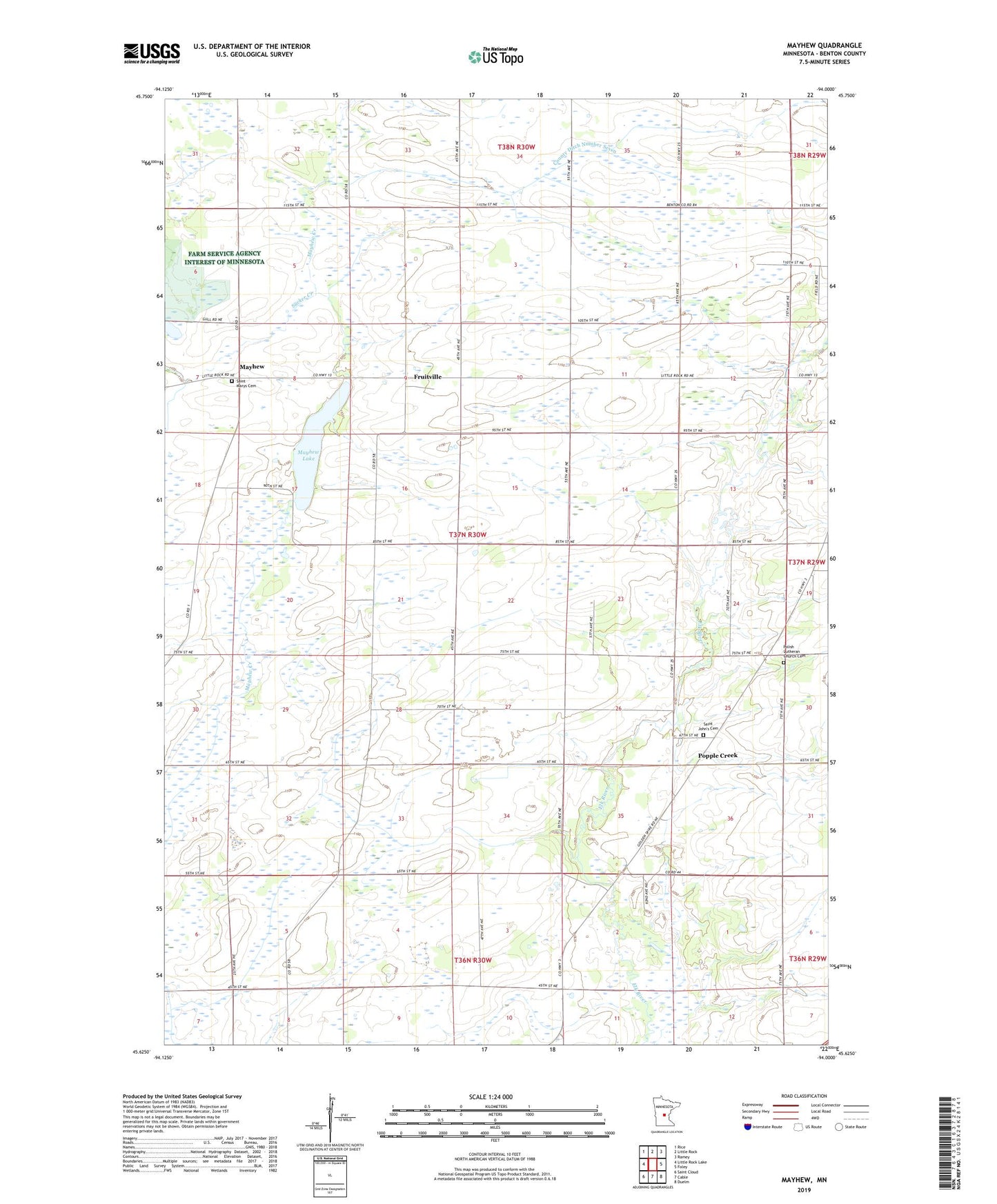
2022 topographic map quadrangle Mayhew in the state of Minnesota. Scale: 1:24000. Based on the newly updated USGS 7.5' US Topo map series, this map is in the following counties: Benton. The map contains contour data, water features, and other items you are used to seeing on USGS maps, but also has updated roads and other features. This is the next generation of topographic maps. Printed on high-quality waterproof paper with UV fade-resistant inks.
Quads adjacent to this one:
West: Little Rock Lake
Northwest: Rice
North: Little Rock
Northeast: Ramey
East: Foley
Southeast: Duelm
South: Cable
Southwest: Saint Cloud
This map covers the same area as the classic USGS quad with code o45094f1.
Contains the following named places: County Ditch Number Four, County Ditch Number Seven, Fruitville, Mayhew, Mayhew Lake, Mayhew Lake Dam, Mayhew Post Office, Polish Lutheran Church Cemetery, Popple Creek, Saint John's Cemetery, Saint Johns Church, Saint Marys Cemetery, Township of Mayhew Lake, ZIP Code: 56379