MyTopo
Cable Minnesota US Topo Map
Couldn't load pickup availability
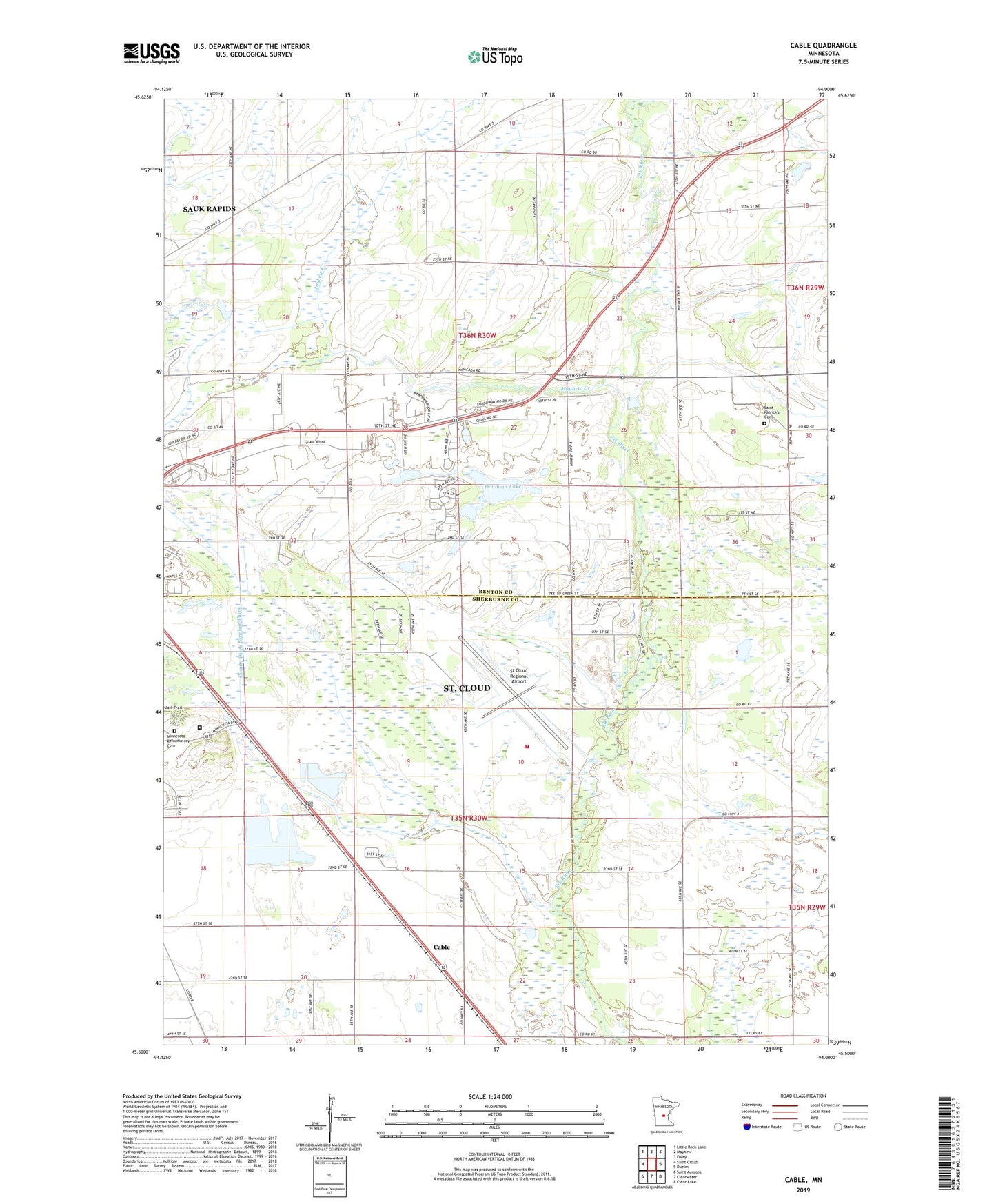
2022 topographic map quadrangle Cable in the state of Minnesota. Scale: 1:24000. Based on the newly updated USGS 7.5' US Topo map series, this map is in the following counties: Benton, Sherburne. The map contains contour data, water features, and other items you are used to seeing on USGS maps, but also has updated roads and other features. This is the next generation of topographic maps. Printed on high-quality waterproof paper with UV fade-resistant inks.
Quads adjacent to this one:
West: Saint Cloud
Northwest: Little Rock Lake
North: Mayhew
Northeast: Foley
East: Duelm
Southeast: Clear Lake
South: Clearwater
Southwest: Saint Augusta
This map covers the same area as the classic USGS quad with code o45094e1.
Contains the following named places: Aysta Field Airport, Cable, Cable Post Office, Central Minnesota Rest Area, County Ditch Number Eleven, County Ditch Number Three, Donovan Lake, First Granite Quarry Historical Marker, Mayhew Creek, Minnesota Correctional Facility - Saint Cloud, Minnesota Reformatory Cemetery, Saint Cloud Campground and RV Park, Saint Cloud Fire Department Station 4, Saint Cloud Historical Marker, Saint Cloud Hospital Heliport, Saint John's Lutheran Church, Saint Patrick's Cemetery, Saint Patricks Church, St Cloud Regional Airport, The Fairways Golf Course, Township of Haven, Township of Minden, Wapicada Golf Course, Woodland Hills Park, ZIP Code: 56304