MyTopo
Gary NW Minnesota US Topo Map
Couldn't load pickup availability
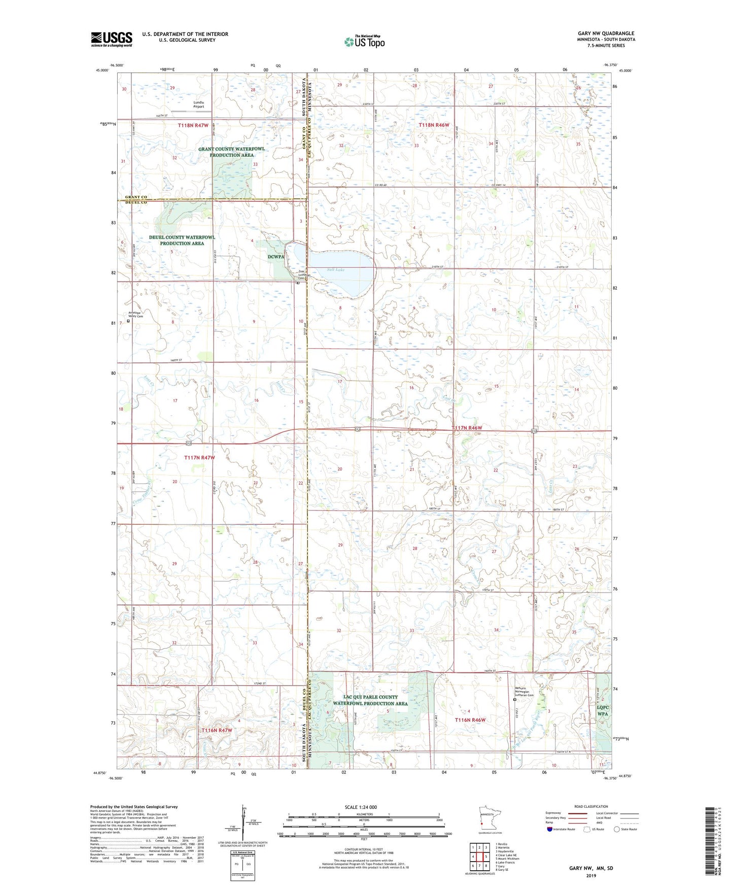
2019 topographic map quadrangle Gary NW in the states of Minnesota, South Dakota. Scale: 1:24000. Based on the newly updated USGS 7.5' US Topo map series, this map is in the following counties: Lac qui Parle, Deuel, Grant. The map contains contour data, water features, and other items you are used to seeing on USGS maps, but also has updated roads and other features. This is the next generation of topographic maps. Printed on high-quality waterproof paper with UV fade-resistant inks.
Quads adjacent to this one:
West: Clear Lake NE
Northwest: Revillo
North: Marietta
Northeast: Haydenville
East: Mount Wickham
Southeast: Gary SE
South: Gary
Southwest: Lake Francis
Contains the following named places: Antelope Valley Cemetery, Antelope Valley Church, Cole School, Crow Creek, Crow Timber Creek, Dacotah State Wildlife Management Area, Lundin Airport, Mehurin Norwegian Lutheran Cemetery, Salt Lake, State Line Wayside Park, Township of Antelope Valley, Township of Mehurin, Wallace Jewett Airstrip, Zoar Church, Zoar Lutheran Cemetery, ZIP Code: 56257