MyTopo
Haydenville Minnesota US Topo Map
Couldn't load pickup availability
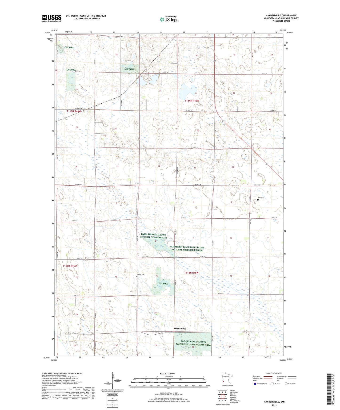
2022 topographic map quadrangle Haydenville in the state of Minnesota. Scale: 1:24000. Based on the newly updated USGS 7.5' US Topo map series, this map is in the following counties: Lac qui Parle. The map contains contour data, water features, and other items you are used to seeing on USGS maps, but also has updated roads and other features. This is the next generation of topographic maps. Printed on high-quality waterproof paper with UV fade-resistant inks.
Quads adjacent to this one:
West: Marietta
Northwest: Rosen
North: Bellingham
Northeast: Correll
East: Madison
Southeast: Dawson NW
South: Mount Wickham
Southwest: Gary NW
This map covers the same area as the classic USGS quad with code o45096a3.
Contains the following named places: Acton Marsh State Wildlife Management Area, Borchardt-Rosin State Wildlife Management A, County Ditch Number Five, Haydenville, Lokken Cemetery, School Number 108, School Number 64, School Number 77, School Number 78, School Number 88, School Number 98, Township of Arena, Township of Perry, Trinity Church, Zion Cemetery, Zion Church