MyTopo
Grygla Minnesota US Topo Map
Couldn't load pickup availability
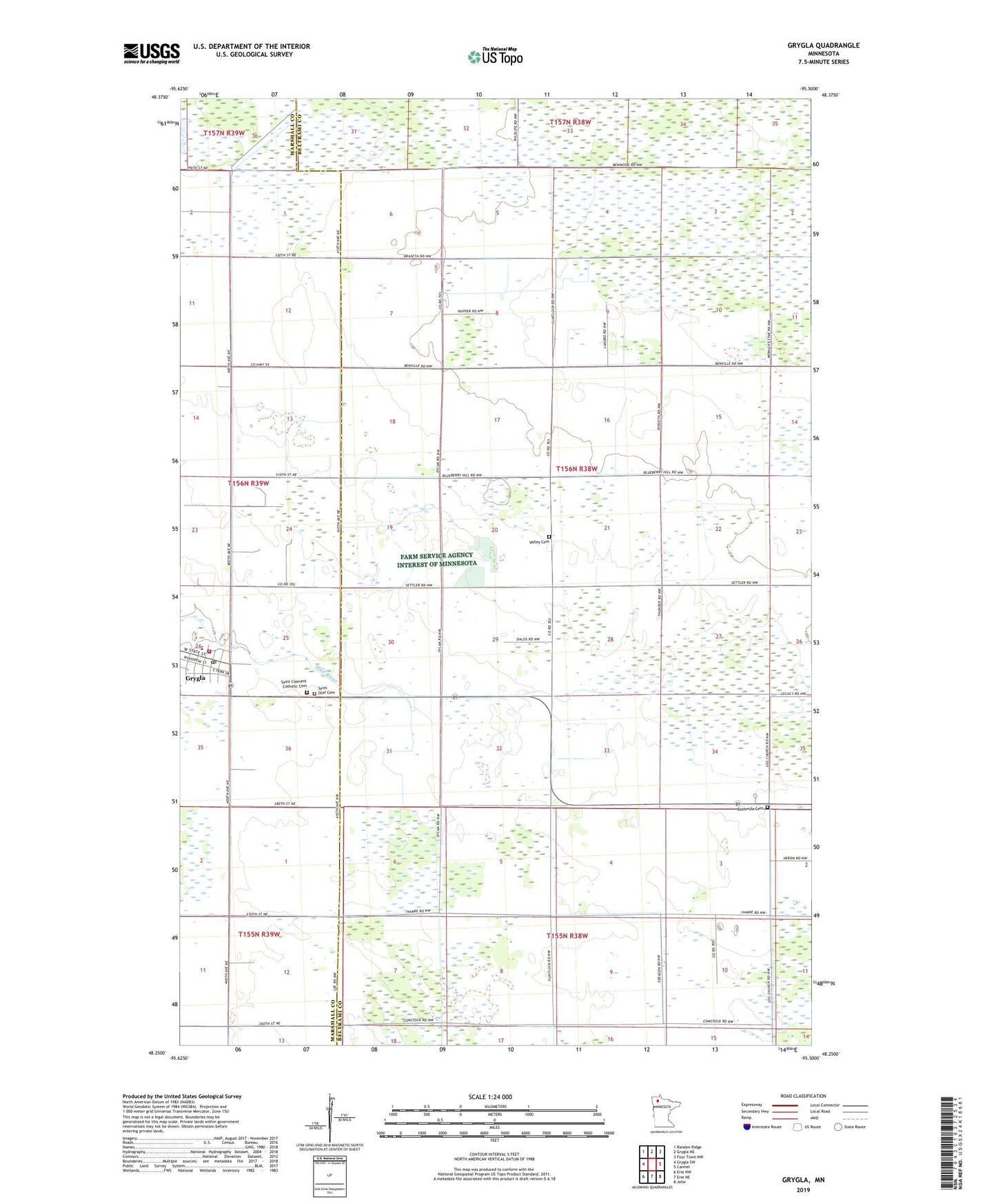
2022 topographic map quadrangle Grygla in the state of Minnesota. Scale: 1:24000. Based on the newly updated USGS 7.5' US Topo map series, this map is in the following counties: Beltrami, Marshall. The map contains contour data, water features, and other items you are used to seeing on USGS maps, but also has updated roads and other features. This is the next generation of topographic maps. Printed on high-quality waterproof paper with UV fade-resistant inks.
Quads adjacent to this one:
West: Grygla SW
Northwest: Randen Ridge
North: Grygla NE
Northeast: Four Town NW
East: Carmel
Southeast: Jelle
South: Erie NE
Southwest: Erie NW
This map covers the same area as the classic USGS quad with code o48095c5.
Contains the following named places: Bethesda Cemetery, Bethesda Church, City of Grygla, Community Bible Church, Grygla, Grygla Elementary and High School, Grygla Fire and Rescue, Grygla Post Office, Grygla State Wildlife Management Area, Grygla Trailer Court, Judicial Ditch Number Eleven, Minnesota Department of Natural Resources Forestry Division Grygla Field Office, Myran Post Office, Saint Clement Catholic Cemetery, Saint Clements Catholic Church, Saint Olaf Cemetery, Township of Benville, Valley Cemetery