MyTopo
Gurneau Lake Minnesota US Topo Map
Couldn't load pickup availability
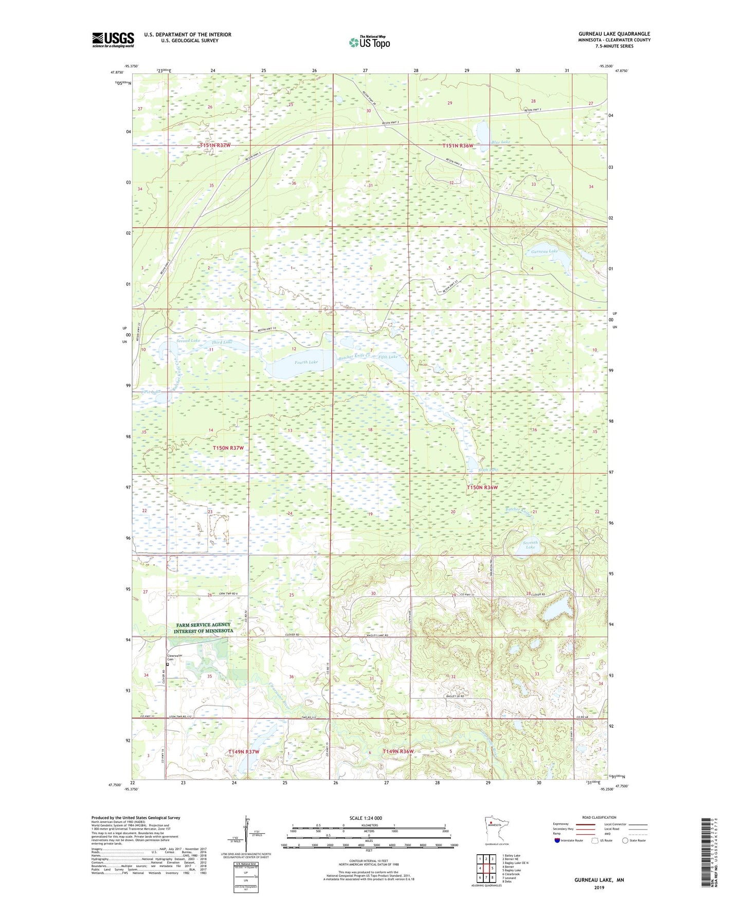
2019 topographic map quadrangle Gurneau Lake in the state of Minnesota. Scale: 1:24000. Based on the newly updated USGS 7.5' US Topo map series, this map is in the following counties: Clearwater. The map contains contour data, water features, and other items you are used to seeing on USGS maps, but also has updated roads and other features. This is the next generation of topographic maps. Printed on high-quality waterproof paper with UV fade-resistant inks.
Quads adjacent to this one:
West: Berner
Northwest: Bailey Lake
North: Berner NE
Northeast: Bagley Lake OE N
East: Bagley Lake
Southeast: Debs
South: Leonard
Southwest: Clearbrook
Contains the following named places: Bardwell Airstrip, Blue Lake, Carver Lake, Churnes Post Office, Clearwater Cemetery, Fifth Lake, First Lake, Fourth Lake, Gurneau Lake, Schoolhouse Lake, Second Lake, Seventh Lake, Sixth Lake, Third Lake, Township of Clover