MyTopo
Hamburg Minnesota US Topo Map
Couldn't load pickup availability
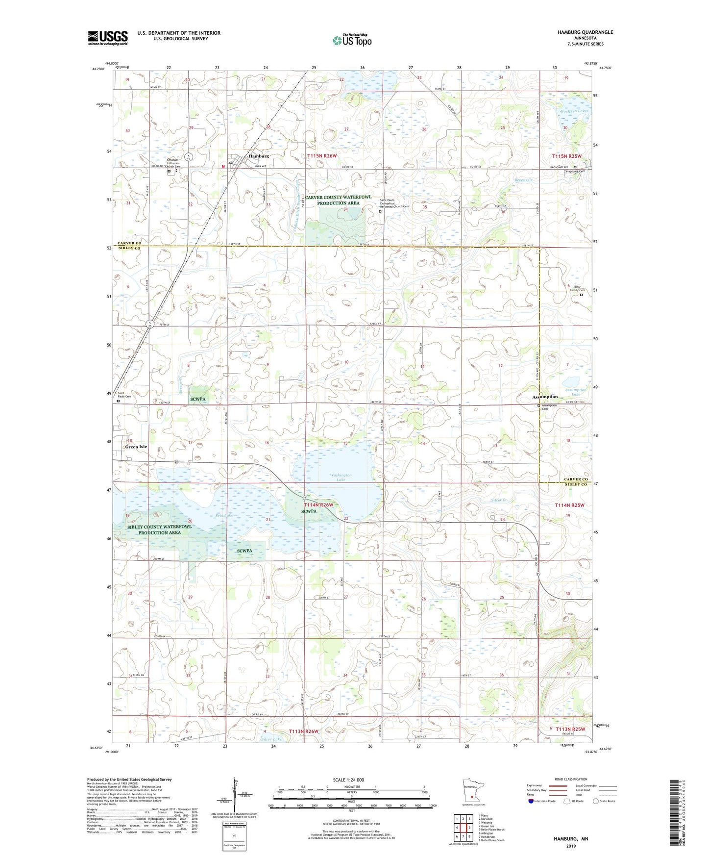
2019 topographic map quadrangle Hamburg in the state of Minnesota. Scale: 1:24000. Based on the newly updated USGS 7.5' US Topo map series, this map is in the following counties: Sibley, Carver. The map contains contour data, water features, and other items you are used to seeing on USGS maps, but also has updated roads and other features. This is the next generation of topographic maps. Printed on high-quality waterproof paper with UV fade-resistant inks.
Quads adjacent to this one:
West: Green Isle
Northwest: Plato
North: Norwood
Northeast: Waconia
East: Belle Plaine North
Southeast: Belle Plaine South
South: Henderson
Southwest: Arlington
Contains the following named places: Assumption, Assumption Cemetery, Assumption Lake, Assumption Post Office, Assumption State Wildlife Management Area, Bovy Family Cemetery, Carver County Waterfowl Production Area, City of Hamburg, County Ditch Number Fiftyseven, County Ditch Number Fortyseven, County Ditch Number Four A, County Ditch Number Thirtynine, County Ditch Number Thirtytwo, County Ditch Number Twelve A, County Ditch Number Twentyfive A, Emanuel Lutheran Church, Emanuel Lutheran Church Cemetery, Emanuel Lutheran School, Erin Lake, Evangelical Reformed Church, Hamburg, Hamburg Bicentennial Park, Hamburg City Hall, Hamburg Fire Department, Hamburg Post Office, Hawks Park, Hoeffken Lake, Judicial Ditch Number Three, Judicial Ditch Number Three A, Ridgeview Ambulance Service Hamburg, Saint Pauls Cemetery, Saint Pauls Church, Saint Paul's Evangelical Reformed Church Cemetery, Saint Pauls School, School Number 25, Sibley County Waterfowl Production Area, Snapsburg Cemetery, Township of Washington Lake, Washington Lake, ZIP Codes: 55338, 55339, 55368