MyTopo
Green Isle Minnesota US Topo Map
Couldn't load pickup availability
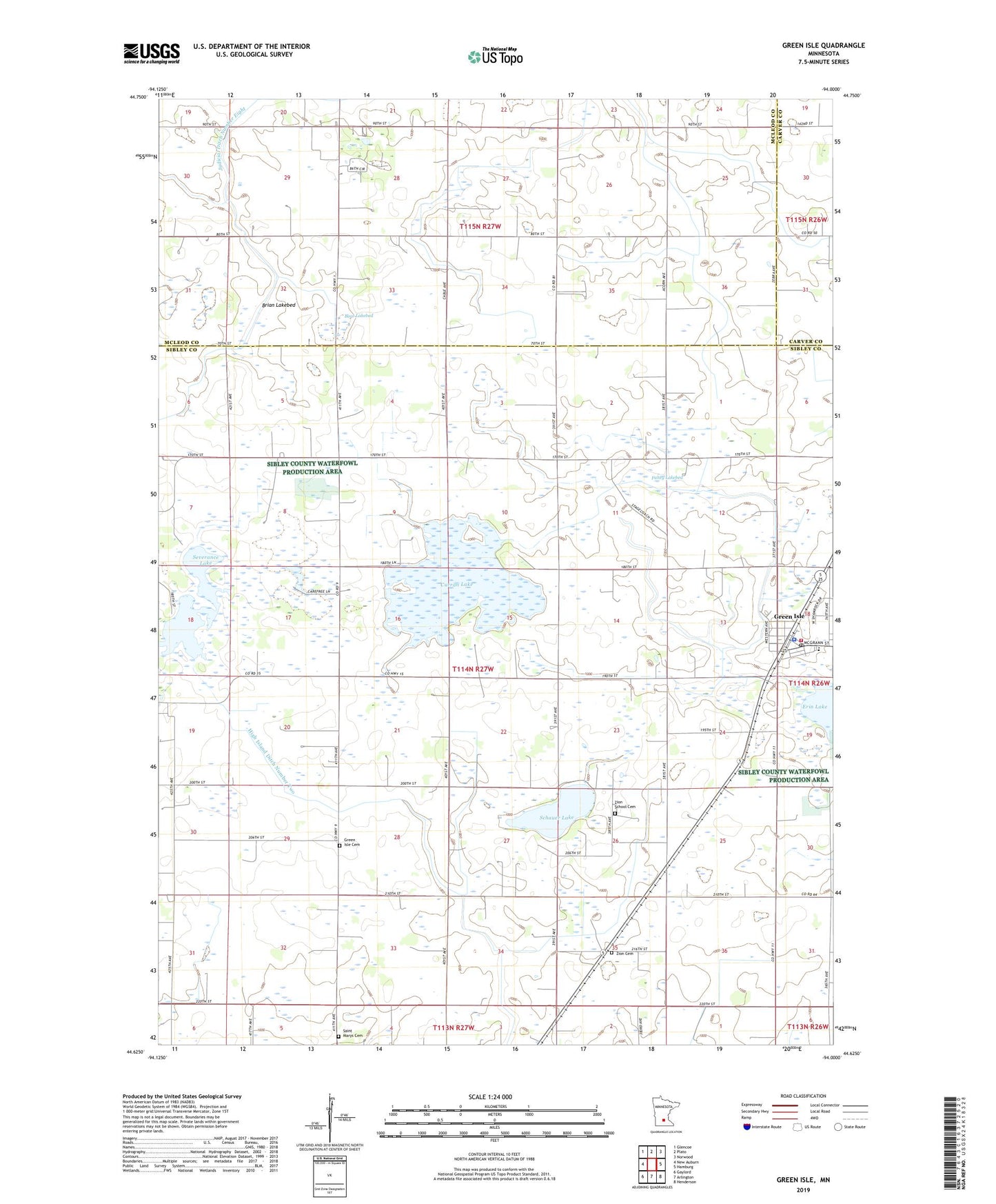
2022 topographic map quadrangle Green Isle in the state of Minnesota. Scale: 1:24000. Based on the newly updated USGS 7.5' US Topo map series, this map is in the following counties: Sibley, McLeod, Carver. The map contains contour data, water features, and other items you are used to seeing on USGS maps, but also has updated roads and other features. This is the next generation of topographic maps. Printed on high-quality waterproof paper with UV fade-resistant inks.
Quads adjacent to this one:
West: New Auburn
Northwest: Glencoe
North: Plato
Northeast: Norwood
East: Hamburg
Southeast: Henderson
South: Arlington
Southwest: Gaylord
This map covers the same area as the classic USGS quad with code o44094f1.
Contains the following named places: Bear Lakebed, Brian Lakebed, City of Green Isle, County Ditch Number Twentynine, Curran Lake, Fahey Lakebed, Green Isle, Green Isle Cemetery, Green Isle City Hall, Green Isle Fire Department, Green Isle Police Department, Green Isle Post Office, High Island Ditch Number Two, Saint Brendan Church, Saint Johns Church, Saint Johns School, Saint Marys Cemetery, Saint Paul's Lutheran Church, Schauer Lake, Severance Lake, Township of Green Isle, Zion Cemetery, Zion School Cemetery