MyTopo
Harder Lake Minnesota US Topo Map
Couldn't load pickup availability
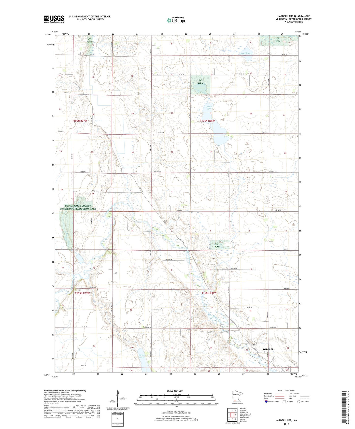
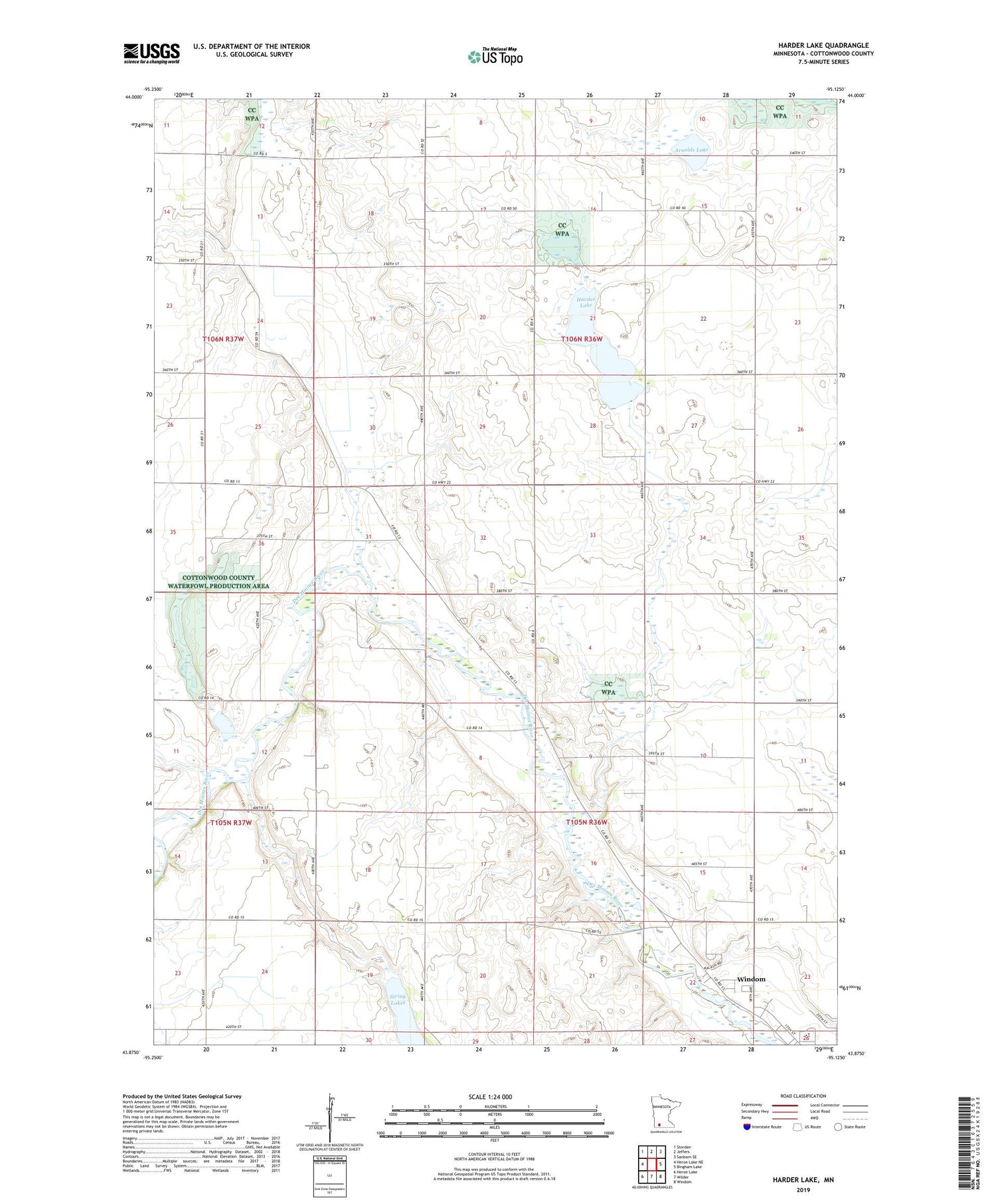
2019 topographic map quadrangle Harder Lake in the state of Minnesota. Scale: 1:24000. Based on the newly updated USGS 7.5' US Topo map series, this map is in the following counties: Cottonwood. The map contains contour data, water features, and other items you are used to seeing on USGS maps, but also has updated roads and other features. This is the next generation of topographic maps. Printed on high-quality waterproof paper with UV fade-resistant inks.
Quads adjacent to this one:
West: Heron Lake NE
Northwest: Storden
North: Jeffers
Northeast: Sanborn SE
East: Bingham Lake
Southeast: Windom
South: Wilder
Southwest: Heron Lake
Contains the following named places: Arnolds Lake, Dynamite County Park, Harder Lake, Jens Park, KDOM-FM (Windom), Township of Dale, Township of Great Bend, Windom Area High School, Windom Country Club, ZIP Code: 56101