MyTopo
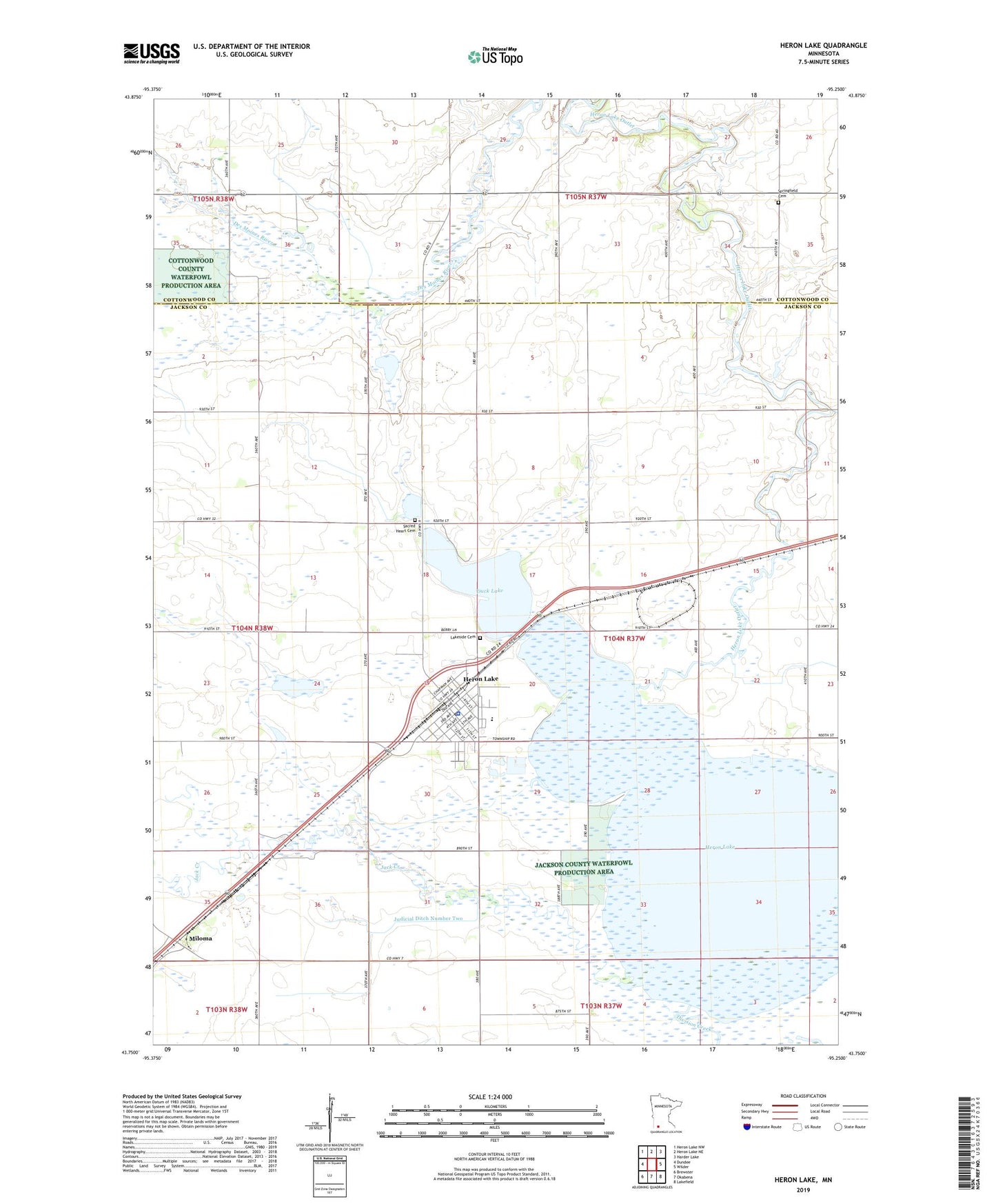
Heron Lake Minnesota US Topo Map
Couldn't load pickup availability
2022 topographic map quadrangle Heron Lake in the state of Minnesota. Scale: 1:24000. Based on the newly updated USGS 7.5' US Topo map series, this map is in the following counties: Jackson, Cottonwood. The map contains contour data, water features, and other items you are used to seeing on USGS maps, but also has updated roads and other features. This is the next generation of topographic maps. Printed on high-quality waterproof paper with UV fade-resistant inks.
Quads adjacent to this one:
West: Dundee
Northwest: Heron Lake NW
North: Heron Lake NE
Northeast: Harder Lake
East: Wilder
Southeast: Lakefield
South: Okabena
Southwest: Brewster
This map covers the same area as the classic USGS quad with code o43095g3.
Contains the following named places: City of Heron Lake, Crosse State Wildlife Management Area, Division Creek, Duck Lake, Evangelical Lutheran Church, Heron Lake, Heron Lake - Okabena Public School, Heron Lake Clinic, Heron Lake Fire and Emergency Medical Services, Heron Lake Fire Department, Heron Lake Memorial Field, Heron Lake Outlet Dam, Heron Lake Police Department, Heron Lake Post Office, Heron Lake Public Library, Jack Creek, Judicial Ditch Number Two, Lakeside Cemetery, Lakeview Home, Miloma, Miloma Post Office, Sacred Heart Cemetery, Sacred Heart Church, Sacred Heart School, Springfield Cemetery, Township of Weimer, United Methodist Church, Winkler State Wildlife Management Area, ZIP Code: 56137