MyTopo
Highland Minnesota US Topo Map
Couldn't load pickup availability
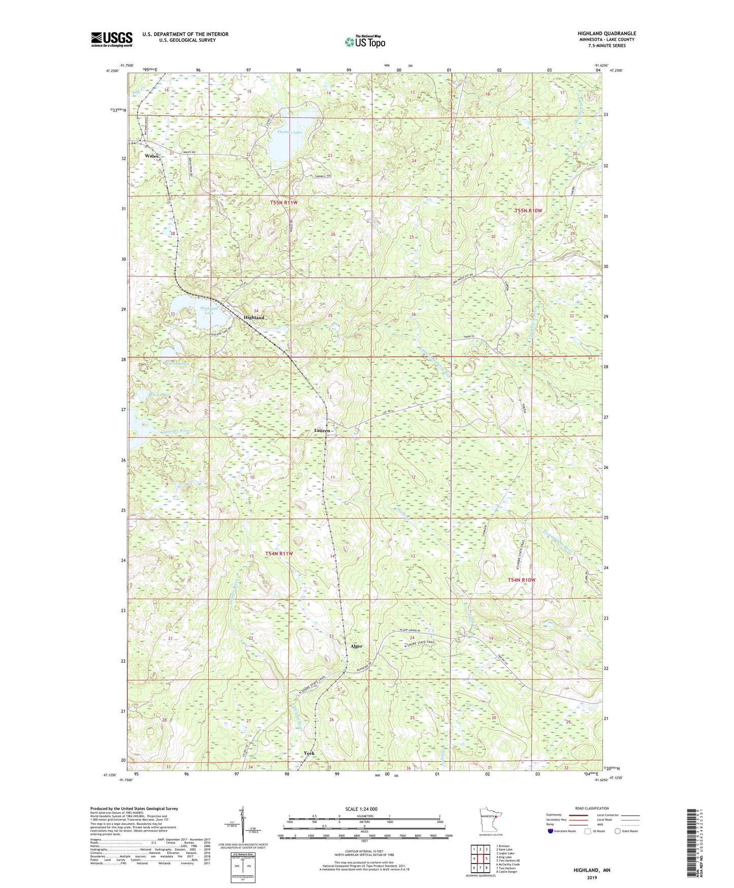
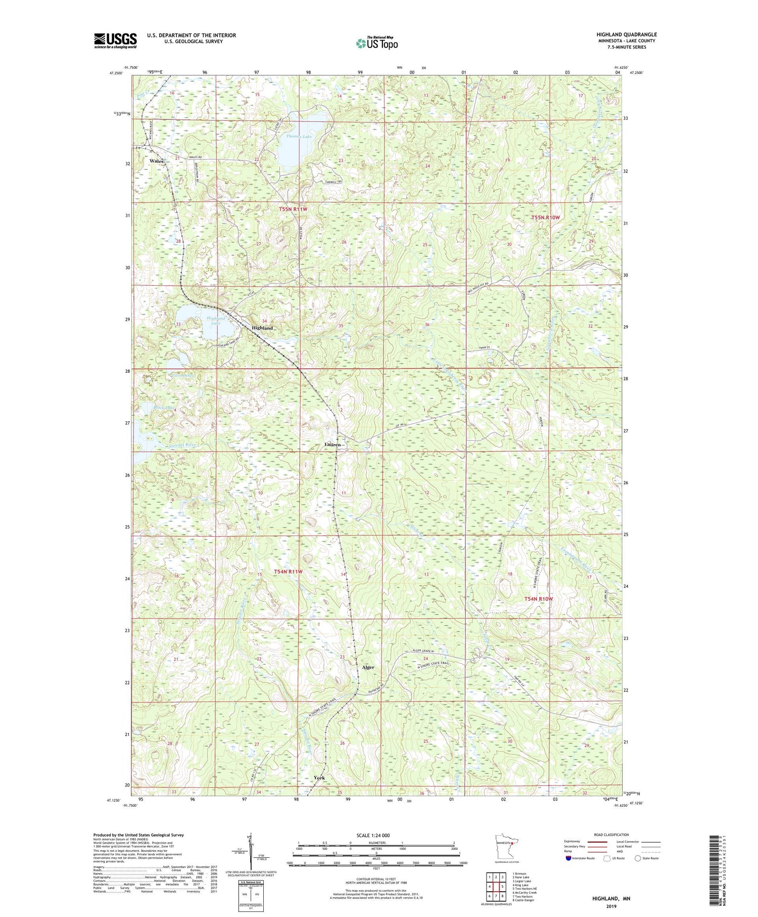
2019 topographic map quadrangle Highland in the state of Minnesota. Scale: 1:24000. Based on the newly updated USGS 7.5' US Topo map series, this map is in the following counties: Lake. The map contains contour data, water features, and other items you are used to seeing on USGS maps, but also has updated roads and other features. This is the next generation of topographic maps. Printed on high-quality waterproof paper with UV fade-resistant inks.
Quads adjacent to this one:
West: King Lake
Northwest: Brimson
North: Kane Lake
Northeast: Legler Lake
East: Two Harbors NE
Southeast: Castle Danger
South: Two Harbors
Southwest: McCarthy Creek
Contains the following named places: Alger, Black Lake, Edwin Hansen Pond Dam, Highland, Highland Lake, Lauren, Little Gooseberry River, Marcy Post Office, Thomas Lake, Twin Lakes, Wales, Wales Post Office, York, ZIP Code: 55616