MyTopo
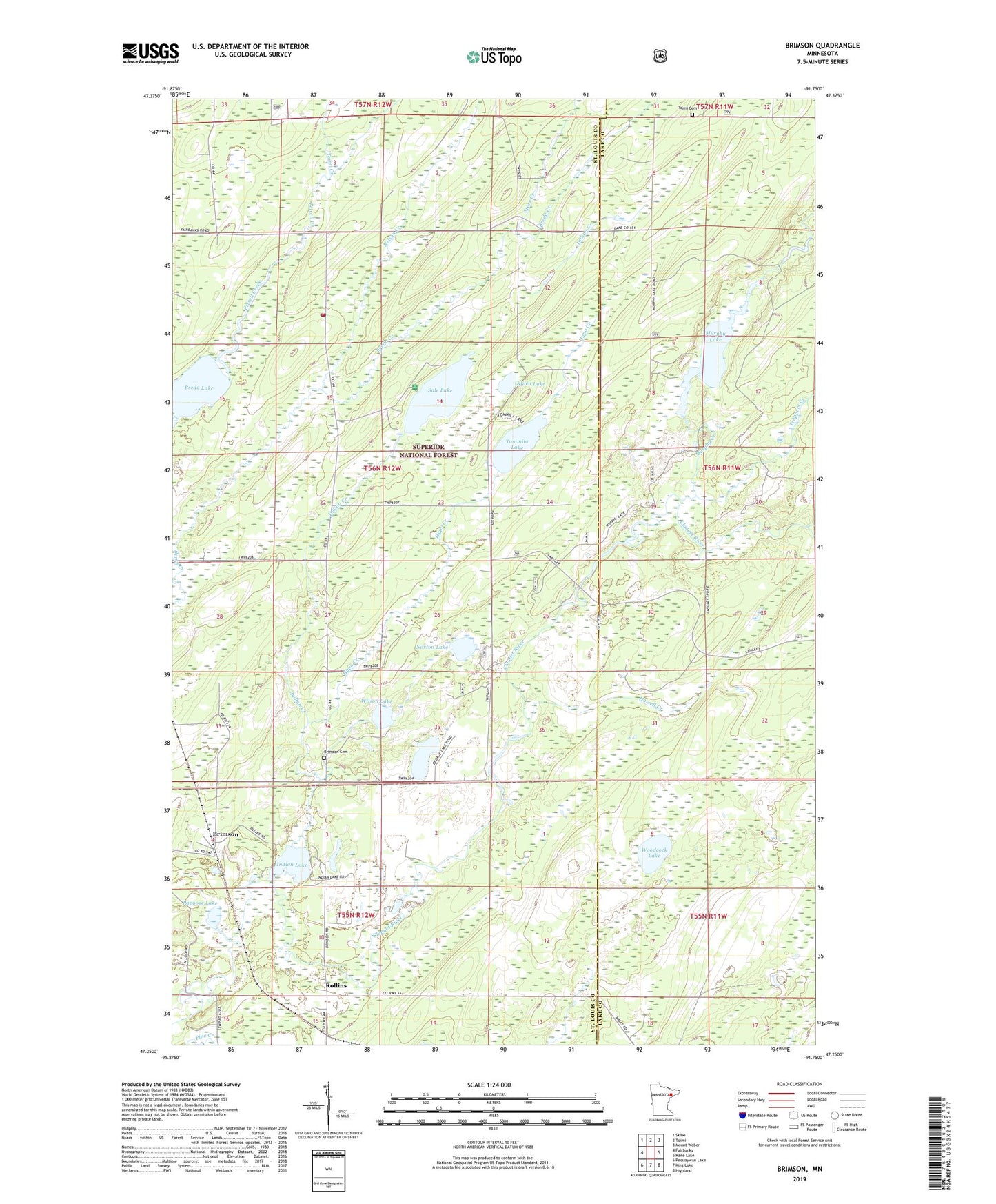
Brimson Minnesota US Topo Map
Couldn't load pickup availability
Also explore the Brimson Forest Service Topo of this same quad for updated USFS data
2022 topographic map quadrangle Brimson in the state of Minnesota. Scale: 1:24000. Based on the newly updated USGS 7.5' US Topo map series, this map is in the following counties: St. Louis, Lake. The map contains contour data, water features, and other items you are used to seeing on USGS maps, but also has updated roads and other features. This is the next generation of topographic maps. Printed on high-quality waterproof paper with UV fade-resistant inks.
Quads adjacent to this one:
West: Fairbanks
Northwest: Skibo
North: Toimi
Northeast: Mount Weber
East: Kane Lake
Southeast: Highland
South: King Lake
Southwest: Pequaywan Lake
This map covers the same area as the classic USGS quad with code o47091c7.
Contains the following named places: Breda Creek, Breda Lake, Brimson, Brimson Area Volunteer Fire Department, Brimson Cemetery, Brimson Post Office, Brimson Station, Camp F E House, George Lake, Howell Creek, Hypo Creek, Indian Creek, Indian Lake, Indian Lake Campground, Kylen Lake, Langley River, Murphy Creek, Murphy Lake, Murphy Lake Number 1 Dam, Nelson Creek, Norton Lake, Papoose Lake, Petrell Post Office, Rhema Fellowship School, Rollins, Sale Lake, Store Creek, Toimi Cemetery, Toimi Creek, Tommila Lake, Trappers Creek, Wilson Lake, Woodcock Lake