MyTopo
Jessie Lake Minnesota US Topo Map
Couldn't load pickup availability
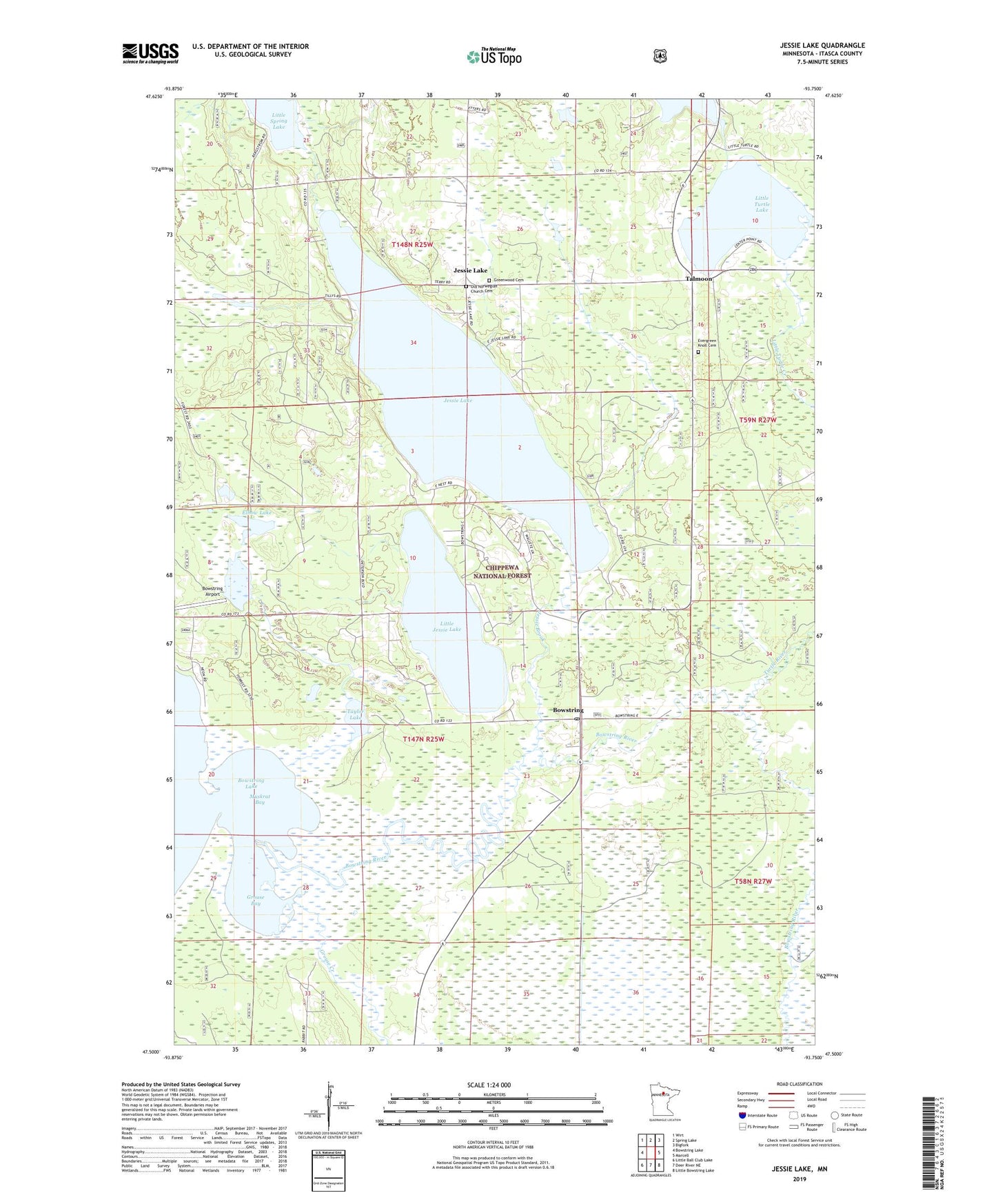
2019 topographic map quadrangle Jessie Lake in the state of Minnesota. Scale: 1:24000. Based on the newly updated USGS 7.5' US Topo map series, this map is in the following counties: Itasca. The map contains contour data, water features, and other items you are used to seeing on USGS maps, but also has updated roads and other features. This is the next generation of topographic maps. Printed on high-quality waterproof paper with UV fade-resistant inks.
Quads adjacent to this one:
West: Bowstring Lake
Northwest: Wirt
North: Spring Lake
Northeast: Bigfork
East: Marcell
Southeast: Little Bowstring Lake
South: Deer River NE
Southwest: Little Ball Club Lake
Contains the following named places: Bowstring, Bowstring Airport, Bowstring Post Office, Elbow Lake, Evergreen Knoll Cemetery, Greenwood Cemetery, Grouse Bay, Grouse Creek, Jesse Lake Post Office, Jessie Brook, Jessie Lake, Jessie Lake Baptist Church, Jessie Lake Lookout Tower, Jessie Lake Lutheran Church, Jessie Lake Pit, Jessie View Resort and Campground, Little Jessie Lake, Little Spring Lake, Little Too Much Lake, Little Turtle Lake, Mack, Muskrat Bay, North Elementary School, Old Norwegian Church Cemetery, Talmoon, Talmoon Post Office, Taylor Lake, Township of Bowstring, Turtle River, ZIP Code: 56637