MyTopo
Marcell Minnesota US Topo Map
Couldn't load pickup availability
Also explore the Marcell Forest Service Topo of this same quad for updated USFS data
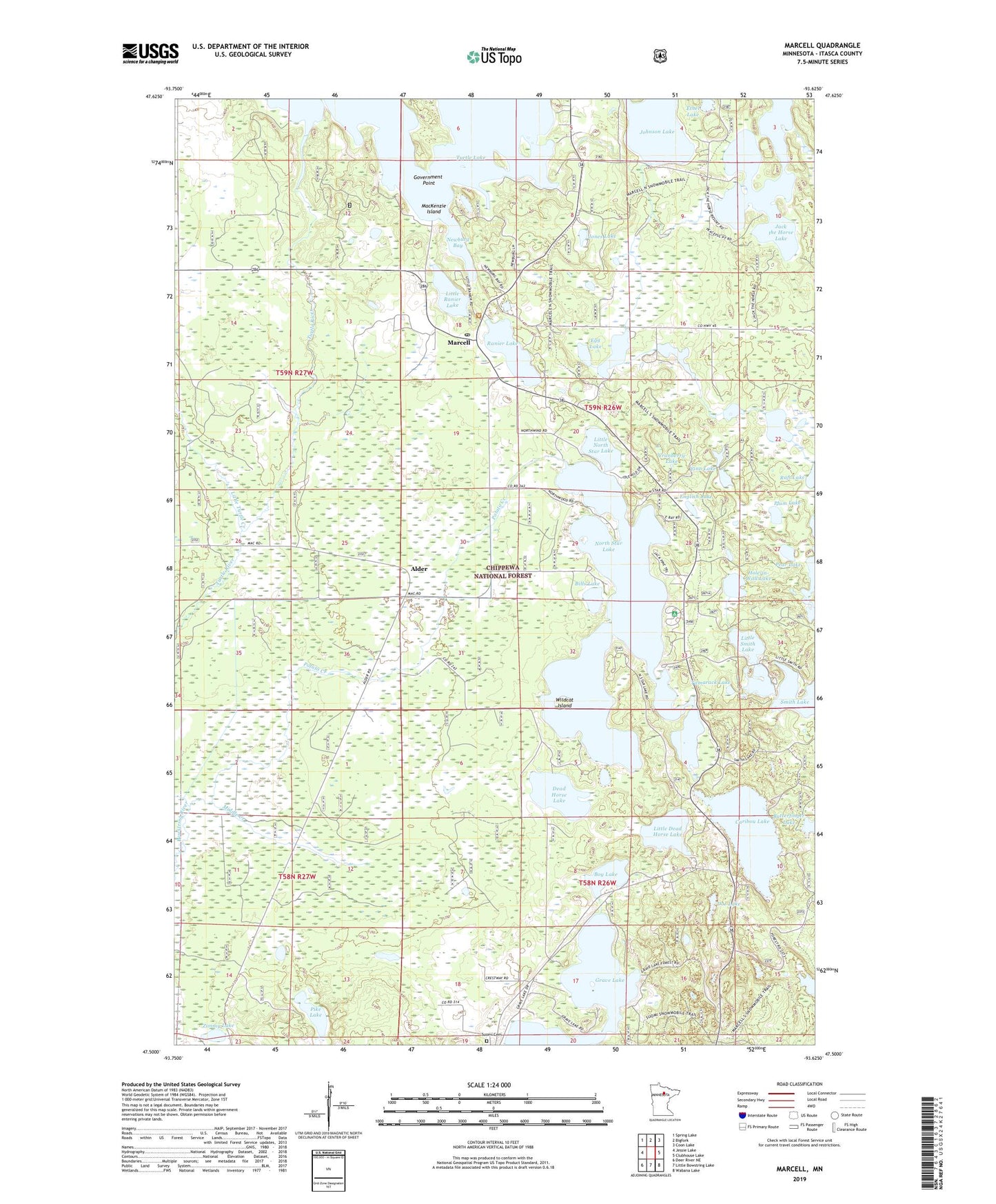
2022 topographic map quadrangle Marcell in the state of Minnesota. Scale: 1:24000. Based on the newly updated USGS 7.5' US Topo map series, this map is in the following counties: Itasca. The map contains contour data, water features, and other items you are used to seeing on USGS maps, but also has updated roads and other features. This is the next generation of topographic maps. Printed on high-quality waterproof paper with UV fade-resistant inks.
Quads adjacent to this one:
West: Jessie Lake
Northwest: Spring Lake
North: Bigfork
Northeast: Coon Lake
East: Clubhouse Lake
Southeast: Wabana Lake
South: Little Bowstring Lake
Southwest: Deer River NE
This map covers the same area as the classic USGS quad with code o47093e6.
Contains the following named places: Alder, Bills Lake, Boy Lake, Butterfinger Lake, Caribou Lake, Carpics Lake, Cranberry Lake, Dead Horse Lake, Doe Lake, Egg Lake, English Lake, Finn Lake, Forest Lake, Government Point, Hole-in-Wall Lake, Itasca County, Jack the Horse Lake, Johnson Lake, Jones Lake, Little Dead Horse Lake, Little North Star Lake, Little Ranier Lake, Little Smith Lake, Little Turtle Creek, MacKenzie Island, Marcell, Marcell Community Church, Marcell Post Office, Middle Creek, Newburg Bay, North Star Campground, North Star Lake, Pear Lake, Pike Lake, Plum Lake, Potato Creek, Ranier Lake, Suomi Cemetery, Tamarack Lake, Township of Marcell, Trestle Landing Boat Ramp, Turtle Lake, West Smith Lake, Wildcat Island, Zimmy Lake, ZIP Code: 56657