MyTopo
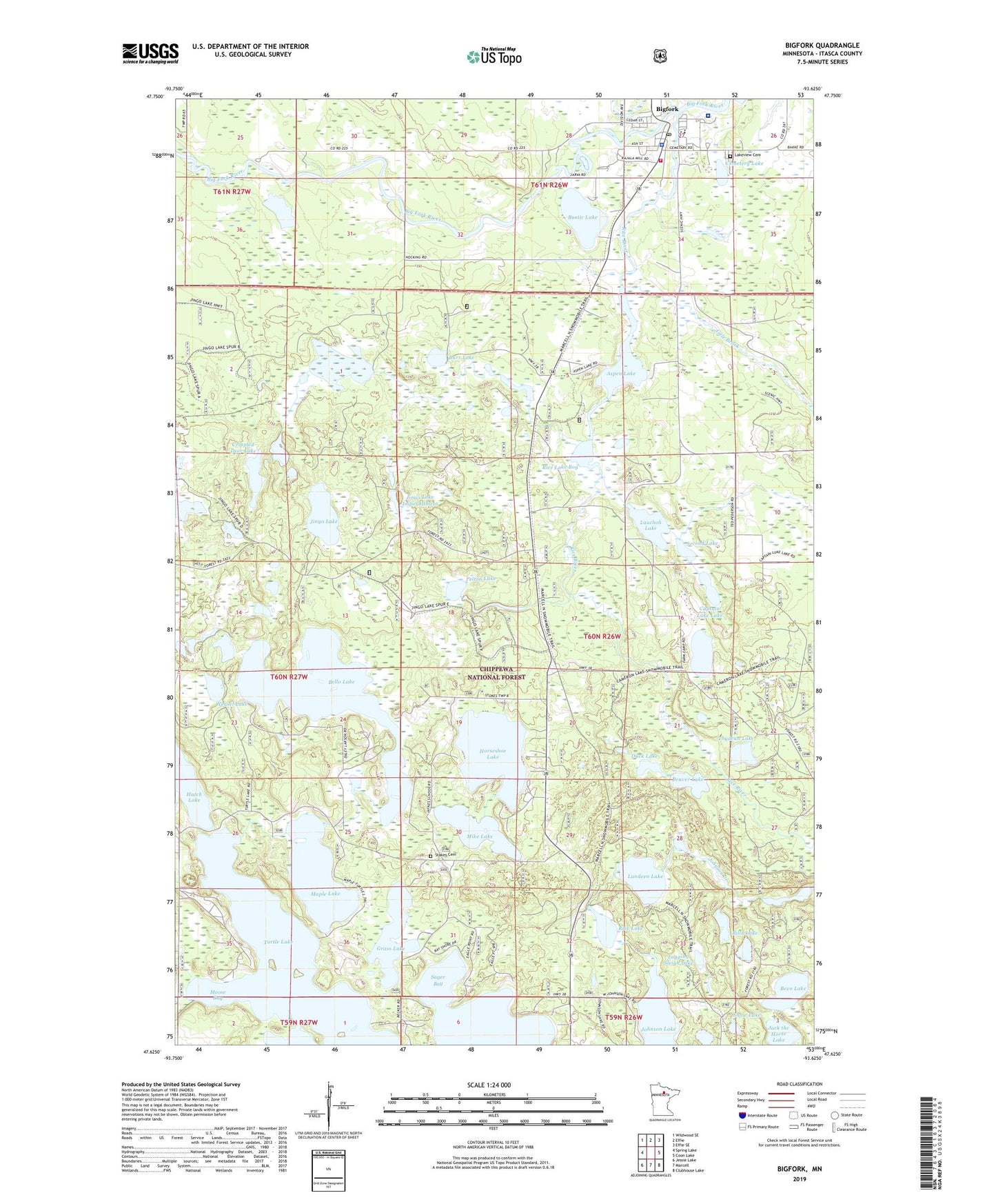
Bigfork Minnesota US Topo Map
Couldn't load pickup availability
Also explore the Bigfork Forest Service Topo of this same quad for updated USFS data
2022 topographic map quadrangle Bigfork in the state of Minnesota. Scale: 1:24000. Based on the newly updated USGS 7.5' US Topo map series, this map is in the following counties: Itasca. The map contains contour data, water features, and other items you are used to seeing on USGS maps, but also has updated roads and other features. This is the next generation of topographic maps. Printed on high-quality waterproof paper with UV fade-resistant inks.
Quads adjacent to this one:
West: Spring Lake
Northwest: Wildwood SE
North: Effie
Northeast: Effie SE
East: Coon Lake
Southeast: Clubhouse Lake
South: Marcell
Southwest: Jessie Lake
This map covers the same area as the classic USGS quad with code o47093f6.
Contains the following named places: Aspen Lake, Beaver Lake, Bello Lake, Bevo Lake, Bigfork, Bigfork Ambulance Service, Bigfork Fire Department, Bigfork Lutheran Church, Bigfork Police Department, Bigfork Post Office, Bigfork Valley Hospital, Billo Lake, Burr Lake, Bustic Lake, Captain Luke Lake, Cemetery Lake, City of Bigfork, Crippled Deer Lake, Duck Lake, Edge of the Wilderness Golf Course, Edmond Lake, Ethel Lake, Gale Brook, Grass Lake, Horseshoe Lake, Jingo Lake, Jingo Lake Dam, Jingo Lake Impoundment, Kingdom Hall of Jehovah's Witnesses, Lakeview Cemetery, Lauchoh Lake, Logging Sleigh Lake, Lundeen Lake, Maple Lake, Mike Lake, Moose Bay, Northern Itasca Nursing Home, Northland Medical Clinic, Our Lady of Snows Catholic Church, Pelton Lake, Presbyterian Church, Rice Lake, Rice Lake Bog, Rice River, Sager Bay, Second Lake, Snells Seaplane Base, Snow Lake, Stakes Cemetery, Stokes Lookout Tower, Thydean Lake, Township of Stokes, Two Island Lake, Weasel Lake