MyTopo
Jordan East Minnesota US Topo Map
Couldn't load pickup availability
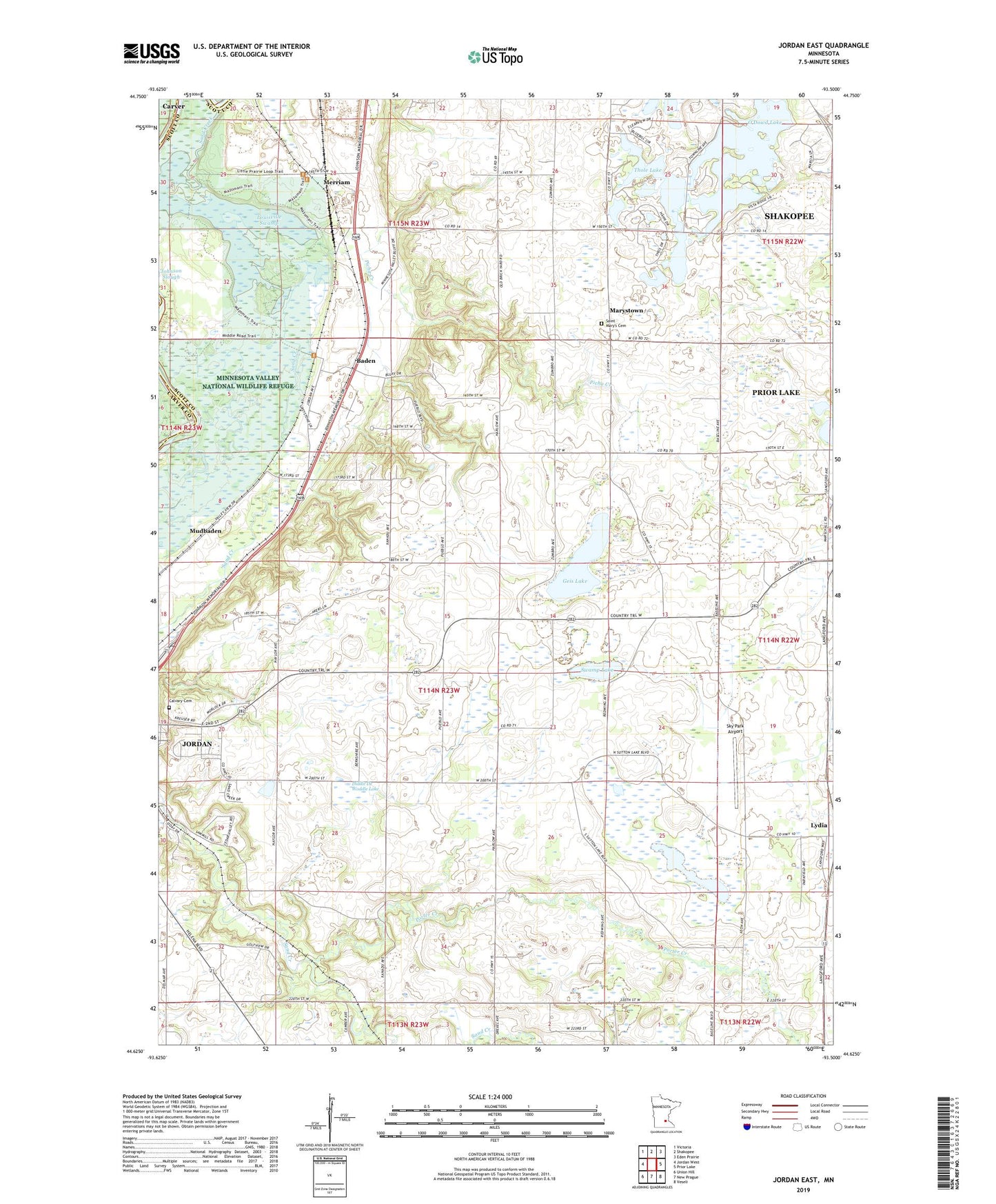
2019 topographic map quadrangle Jordan East in the state of Minnesota. Scale: 1:24000. Based on the newly updated USGS 7.5' US Topo map series, this map is in the following counties: Scott, Carver. The map contains contour data, water features, and other items you are used to seeing on USGS maps, but also has updated roads and other features. This is the next generation of topographic maps. Printed on high-quality waterproof paper with UV fade-resistant inks.
Quads adjacent to this one:
West: Jordan West
Northwest: Victoria
North: Shakopee
Northeast: Eden Prairie
East: Prior Lake
Southeast: Veseli
South: New Prague
Southwest: Union Hill
Contains the following named places: Baden, Bendzick Pond, Calvary Cemetery, Diddle De Woddle Lake, Geis Lake, Helena, Helena Post Office, Jim's Apple Farm, Louisville Swamp, Lydia, Lydia Post Office, Marystown, Marystown Post Office, Merriam, Merriam Post Office, Minneapolis Southwest KOA Kampground, Minnesota Valley National Wildlife Refuge, Mudbaden, Mudbaden Post Office, O'Dowd Lake, Picha Creek, Porter Creek, Ridges of Sand Creek, Saint Josephs, Saint Josephs School, Saint Mary's Cemetery, Sand Creek, Schneider Lake, Scott County, Sky Park Airport, Sutton Lake, Swamp Lake, Theis-Bendzick Pond Dam, Thole Lake, Township of Louisville, Township of Sand Creek, ZIP Code: 55352