MyTopo
Victoria Minnesota US Topo Map
Couldn't load pickup availability
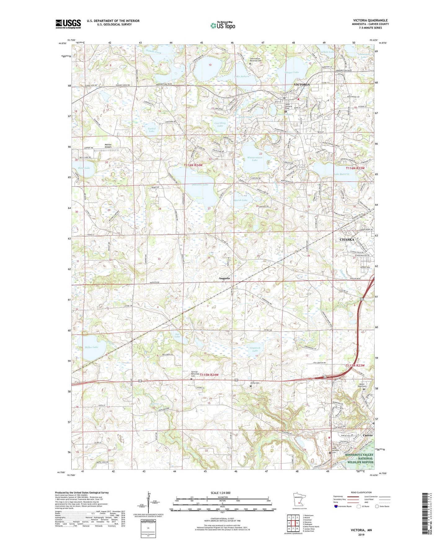
2022 topographic map quadrangle Victoria in the state of Minnesota. Scale: 1:24000. Based on the newly updated USGS 7.5' US Topo map series, this map is in the following counties: Carver. The map contains contour data, water features, and other items you are used to seeing on USGS maps, but also has updated roads and other features. This is the next generation of topographic maps. Printed on high-quality waterproof paper with UV fade-resistant inks.
Quads adjacent to this one:
West: Waconia
Northwest: Watertown
North: Mound
Northeast: Excelsior
East: Shakopee
Southeast: Jordan East
South: Jordan West
Southwest: Belle Plaine North
This map covers the same area as the classic USGS quad with code o44093g6.
Contains the following named places: Aue Lake, Augusta, Augusta Post Office, Batzli Wildlife Pond, Carl Krey Lake, Carver, Carver Fire Department, Carver Post Office, Chaska Town Corner, Church Lake, City of Carver, City of Victoria, Clover Ridge Elementary School, Dahlgreen Golf Club, Dahlgren, Dahlgren Post Office, Dahlgren Railroad Station, Deardorff Orchards, Deer Run Golf Club, Elizabeth Batzli Wildlife Pond Dam, Gaystock Lake, German Reformed Cemetery, Grace Baptist Church, Holy Family Catholic High School, Kelzer Pond, Lake Auburn, Lake Auburn Church, Lake Auburn Moravian Cemetery, Lake Bavaria, Lakeview Clinic, Marsh Lake, Miller Lake, Minnesota Valley Baptist School, Molnau Airpark, Mount Hope Cemetery, Piersons Lake, Preiss Cemetery, Ray Buesgens Wildlife Pond Dam, Reitz Lake, Saint Nicholas Cemetery, Saint Victoria Catholic Church, Saint Victoria Cemetery, School Number 106, Stieger Lake, Tamarack Lake, Township of Chaska, Township of Dahlgren, Township of Laketown, Turbid Lake, Victoria, Victoria Care Center, Victoria City Hall, Victoria Elementary School, Victoria Fire Department, Victoria Post Office, Wassermann Lake, Zoar Church, ZIP Codes: 55318, 55386