MyTopo
Keewatin Minnesota US Topo Map
Couldn't load pickup availability
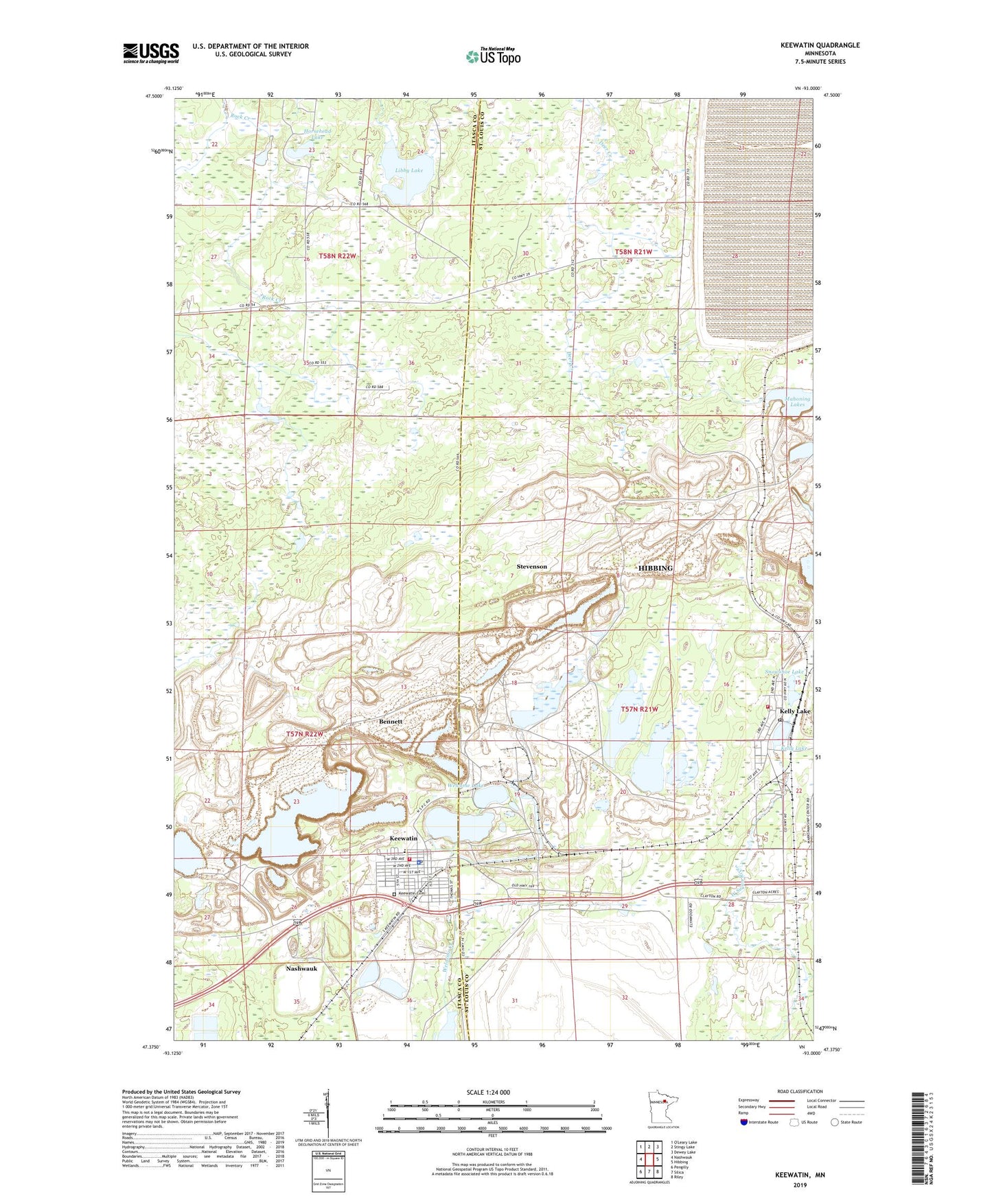
2019 topographic map quadrangle Keewatin in the state of Minnesota. Scale: 1:24000. Based on the newly updated USGS 7.5' US Topo map series, this map is in the following counties: St. Louis, Itasca. The map contains contour data, water features, and other items you are used to seeing on USGS maps, but also has updated roads and other features. This is the next generation of topographic maps. Printed on high-quality waterproof paper with UV fade-resistant inks.
Quads adjacent to this one:
West: Nashwauk
North: Stingy Lake
Northeast: Dewey Lake
East: Hibbing
Southeast: Riley
South: Silica
Southwest: Pengilly
Contains the following named places: Alexander Mine, Bennett, Bennett Mine, Bray Mine, Carlz Mine, City of Keewatin, Congregation of the Good Shepherd, Forest Mine, Hibbing Fire Department Station 3, Horsehead Lake, Keewatin, Keewatin Cemetery, Keewatin Elementary School, Keewatin Fire Department, Keewatin Police Department, Keewatin Post Office, Keewatin Public Library, Kelly Lake, Kelly Lake Post Office, Kelly Lake Station, Lamberton Mine, Libby Lake, Mace Number One Mine, Mahoning Lakes, Mesabi Chief Mine, Mesabi Range, Mississippi Number One Mine, North Russell Mine, Olson's Mobile Home Park, Perry Mine, Saint Mary's Catholic Church, Saint Paul Mine, Sargent Mine, Section Eighteen Mine, Snowshoe Lake, South Russell Mine, Stein Mine, Stevenson, Stevenson Mine, Stevenson Post Office, Township of Stuntz, United Methodist Church, Welcome Lake, WKKQ-AM (Nashwauk), ZIP Code: 55753