MyTopo
Riley Minnesota US Topo Map
Couldn't load pickup availability
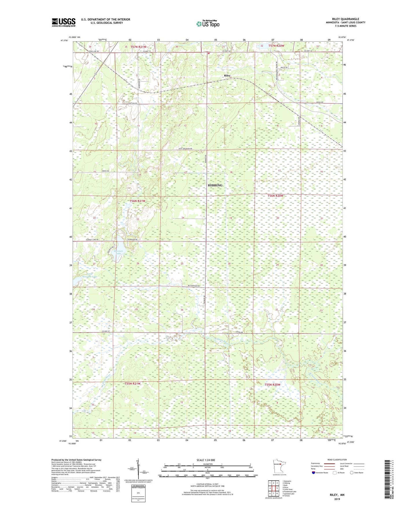
2022 topographic map quadrangle Riley in the state of Minnesota. Scale: 1:24000. Based on the newly updated USGS 7.5' US Topo map series, this map is in the following counties: St. Louis. The map contains contour data, water features, and other items you are used to seeing on USGS maps, but also has updated roads and other features. This is the next generation of topographic maps. Printed on high-quality waterproof paper with UV fade-resistant inks.
Quads adjacent to this one:
West: Silica
Northwest: Keewatin
North: Hibbing
Northeast: Buhl
East: Little Swan
Southeast: Toivola
South: Upstead Lake
Southwest: Floodwood Lake
This map covers the same area as the classic USGS quad with code o47092c8.
Contains the following named places: Floodwood Memorial Forest, Harriett Lake, Hibbing Fire Department - Station 2 - Town Line Road, Little Harriett Lake, Maple Hill School, Riley, ZIP Code: 55746