MyTopo
Silica Minnesota US Topo Map
Couldn't load pickup availability
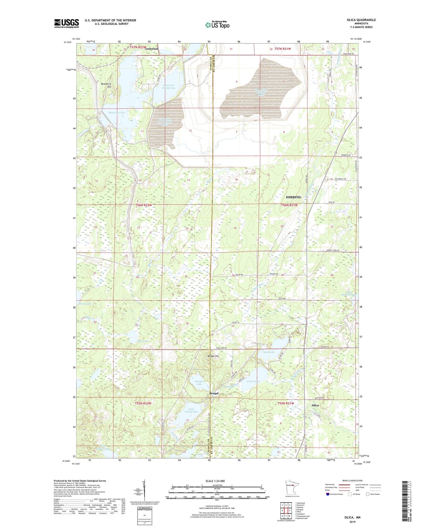
2022 topographic map quadrangle Silica in the state of Minnesota. Scale: 1:24000. Based on the newly updated USGS 7.5' US Topo map series, this map is in the following counties: St. Louis, Itasca. The map contains contour data, water features, and other items you are used to seeing on USGS maps, but also has updated roads and other features. This is the next generation of topographic maps. Printed on high-quality waterproof paper with UV fade-resistant inks.
Quads adjacent to this one:
West: Pengilly
Northwest: Nashwauk
North: Keewatin
Northeast: Hibbing
East: Riley
Southeast: Upstead Lake
South: Floodwood Lake
Southwest: Goodland
This map covers the same area as the classic USGS quad with code o47093c1.
Contains the following named places: Bengal, Bengal Hill, Bengal Lake, Bengal Post Office, Blueberry Hill, Coons Creek, Coons Lake, Hay Lake, Little Fowler Lake, Little Island Lake, Nspc Initial Tailings Basin, Nspc Initial Tailings Dike, Nspc Stage Two Tailings Basin, Nspc Stage Two Tailings Dike, Reservoir Number Six, Reservoir Number Six Dam, Reservoir Two, Reservoir Two Dam, Sand Lake, Silica, Tank Creek, WTBX-FM (Hibbing)