MyTopo
Kenyon Minnesota US Topo Map
Couldn't load pickup availability
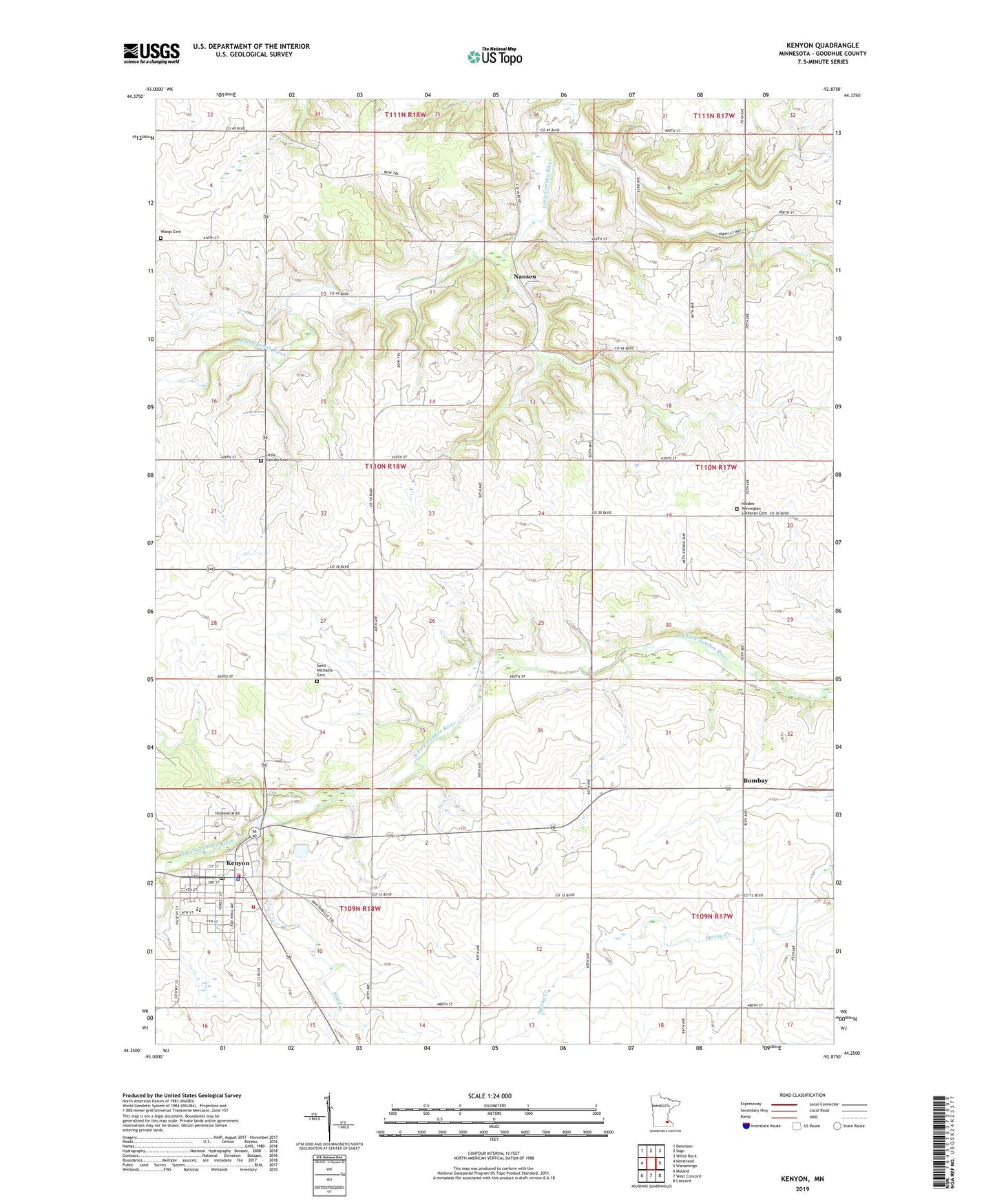
2019 topographic map quadrangle Kenyon in the state of Minnesota. Scale: 1:24000. Based on the newly updated USGS 7.5' US Topo map series, this map is in the following counties: Goodhue. The map contains contour data, water features, and other items you are used to seeing on USGS maps, but also has updated roads and other features. This is the next generation of topographic maps. Printed on high-quality waterproof paper with UV fade-resistant inks.
Quads adjacent to this one:
West: Nerstrand
Northwest: Dennison
North: Sogn
Northeast: White Rock
East: Wanamingo
Southeast: Concord
South: West Concord
Southwest: Moland
Contains the following named places: Bombay, City of Kenyon, Holden Church, Holden Norwegian Lutheran Cemetery, Kanyon Mayo Family Practice Center, Kenyon, Kenyon Elementary School, Kenyon Fire Department, Kenyon Heliport, Kenyon High School, Kenyon Police Department, Kenyon Post Office, Kenyon Public Library, Kenyon Sunset Home, Little Cannon Cemetery, Nansen, Nansen Post Office, Pearl Creek, Saint John's United Church of Christ, Saint Michael's Catholic Church, Saint Michaels Cemetery, Township of Holden, United Methodist Church, Valley View Orchard, Wangs Cemetery, ZIP Code: 55946