MyTopo
Concord Minnesota US Topo Map
Couldn't load pickup availability
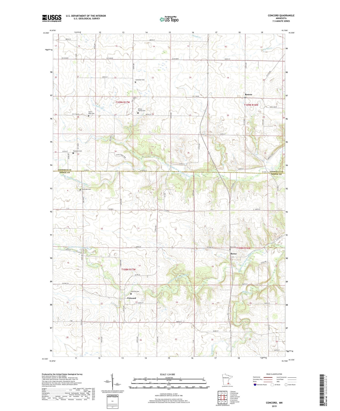
2022 topographic map quadrangle Concord in the state of Minnesota. Scale: 1:24000. Based on the newly updated USGS 7.5' US Topo map series, this map is in the following counties: Dodge, Goodhue. The map contains contour data, water features, and other items you are used to seeing on USGS maps, but also has updated roads and other features. This is the next generation of topographic maps. Printed on high-quality waterproof paper with UV fade-resistant inks.
Quads adjacent to this one:
West: West Concord
Northwest: Kenyon
North: Wanamingo
Northeast: Zumbrota
East: Pine Island
Southeast: Byron
South: Dodge Center
Southwest: Claremont
This map covers the same area as the classic USGS quad with code o44092b7.
Contains the following named places: Andrist Cemetery, Bern Cemetery, Berne, Berne Post Office, Comstock Cemetery, Concord, Concord Cemetery, Concord Church of Christ, Concord Post Office, Devlin Creek, Fairpoint Cemetery, Fairpoint Post Office, Kelsey Family Cemetery, Milliken Creek, Riverside Cemetery, Roscoe, Roscoe Post Office, Saint Agnes Catholic Church, Saint Rose Cemetery, Saint Rose Church, Township of Cherry Grove, Township of Concord, Walter Buehler Detention Dam