MyTopo
Lake Benton Minnesota US Topo Map
Couldn't load pickup availability
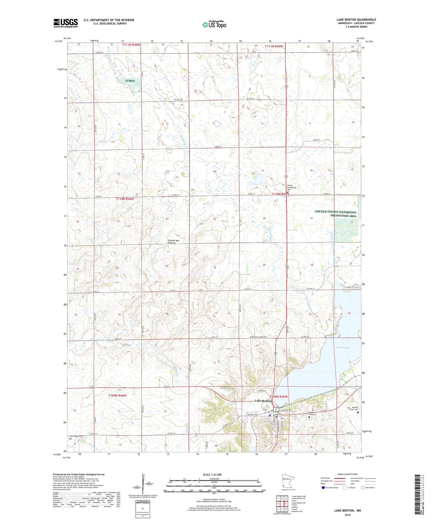
2022 topographic map quadrangle Lake Benton in the state of Minnesota. Scale: 1:24000. Based on the newly updated USGS 7.5' US Topo map series, this map is in the following counties: Lincoln. The map contains contour data, water features, and other items you are used to seeing on USGS maps, but also has updated roads and other features. This is the next generation of topographic maps. Printed on high-quality waterproof paper with UV fade-resistant inks.
Quads adjacent to this one:
West: Lake Benton SW
Northwest: Lake Benton NW
North: Lake Benton NE
Northeast: Arco
East: Tyler
Southeast: Ruthton NW
South: Verdi
Southwest: Elkton
This map covers the same area as the classic USGS quad with code o44096c3.
Contains the following named places: Briffett Family Cemetery, Church of Saint Genevieve, City of Lake Benton, Collinson State Wildlife Management Area, County Ditch Number Thirtyfive, County Ditch Number Thirtyfour, County Ditch Number Twenty, Danish Evangelical Cemetery, Diamond Lake Church, Emerald State Wildlife Management Area, First Baptist Church, Grace Lutheran Church, Horse State Wildlife Management Area, Immanuel Cemetery, Immanuel Church, Kingdom Hall of Jehovahs Witnesses, KKCK-FM (Marshall), Lake Benton, Lake Benton Fire Department, Lake Benton Health Clinic, Lake Benton Library, Lake Benton Police Department, Lake Benton Post Office, Lake Benton Public School, Memorial Hill Cemetery, Minnesota Noname Number 4 Dam, Norwegian Creek, Saint John's Evangelical Lutheran Church, Sioux Lookout State Wildlife Management Area, Township of Diamond Lake, Two Sloughs State Wildlife Management Area, United Methodist Church, ZIP Code: 56149