
MyTopo
Lake Benton NW Minnesota US Topo Map
Couldn't load pickup availability
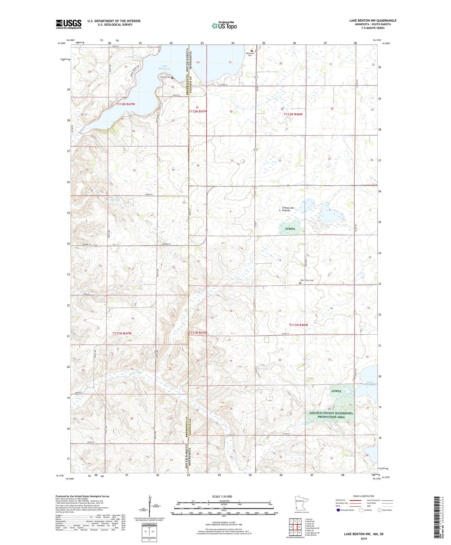
2019 topographic map quadrangle Lake Benton NW in the states of Minnesota, South Dakota. Scale: 1:24000. Based on the newly updated USGS 7.5' US Topo map series, this map is in the following counties: Lincoln, Brookings. The map contains contour data, water features, and other items you are used to seeing on USGS maps, but also has updated roads and other features. This is the next generation of topographic maps. Printed on high-quality waterproof paper with UV fade-resistant inks.
Quads adjacent to this one:
West: White NE
Northwest: Astoria
North: Hendricks
Northeast: Canby SE
East: Lake Benton NE
Southeast: Lake Benton
South: Lake Benton SW
Southwest: White SE
Contains the following named places: County Ditch Number Eight, County Ditch Number Eleven, Hendricks Cemetery, Kvermo State Wildlife Management Area, Lake Hendricks, Lake Hendricks State Recreation Area, New Grove Cemetery, New Grove Church, Shaokatan State Wildlife Management Area, Township of Lake Hendricks, Township of Shaokatan, Trulock Cemetery, ZIP Code: 56136


