MyTopo
White NE South Dakota US Topo Map
Couldn't load pickup availability
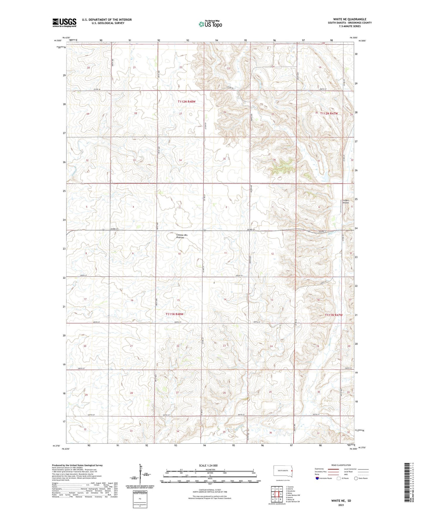
2021 topographic map quadrangle White NE in the state of South Dakota. Scale: 1:24000. Based on the newly updated USGS 7.5' US Topo map series, this map is in the following counties: Brookings. The map contains contour data, water features, and other items you are used to seeing on USGS maps, but also has updated roads and other features. This is the next generation of topographic maps. Printed on high-quality waterproof paper with UV fade-resistant inks.
Quads adjacent to this one:
West: White
Northwest: Toronto
North: Astoria
Northeast: Hendricks
East: Lake Benton NW
Southeast: Lake Benton SW
South: White SE
Southwest: Aurora
This map covers the same area as the classic USGS quad with code o44096d5.
Contains the following named places: Deer Creek, Gilleys Grove, Hidewoods, Lutgen Airport, Norfeld Colony, Norfeld Colony Census Designated Place, Norfeld Colony Elementary School, Norfeld Colony High School, Township of Oak Lake, Township of Sherman, UDLH Flood Control Dam, ZIP Code: 57276