MyTopo
Lake Fremont Minnesota US Topo Map
Couldn't load pickup availability
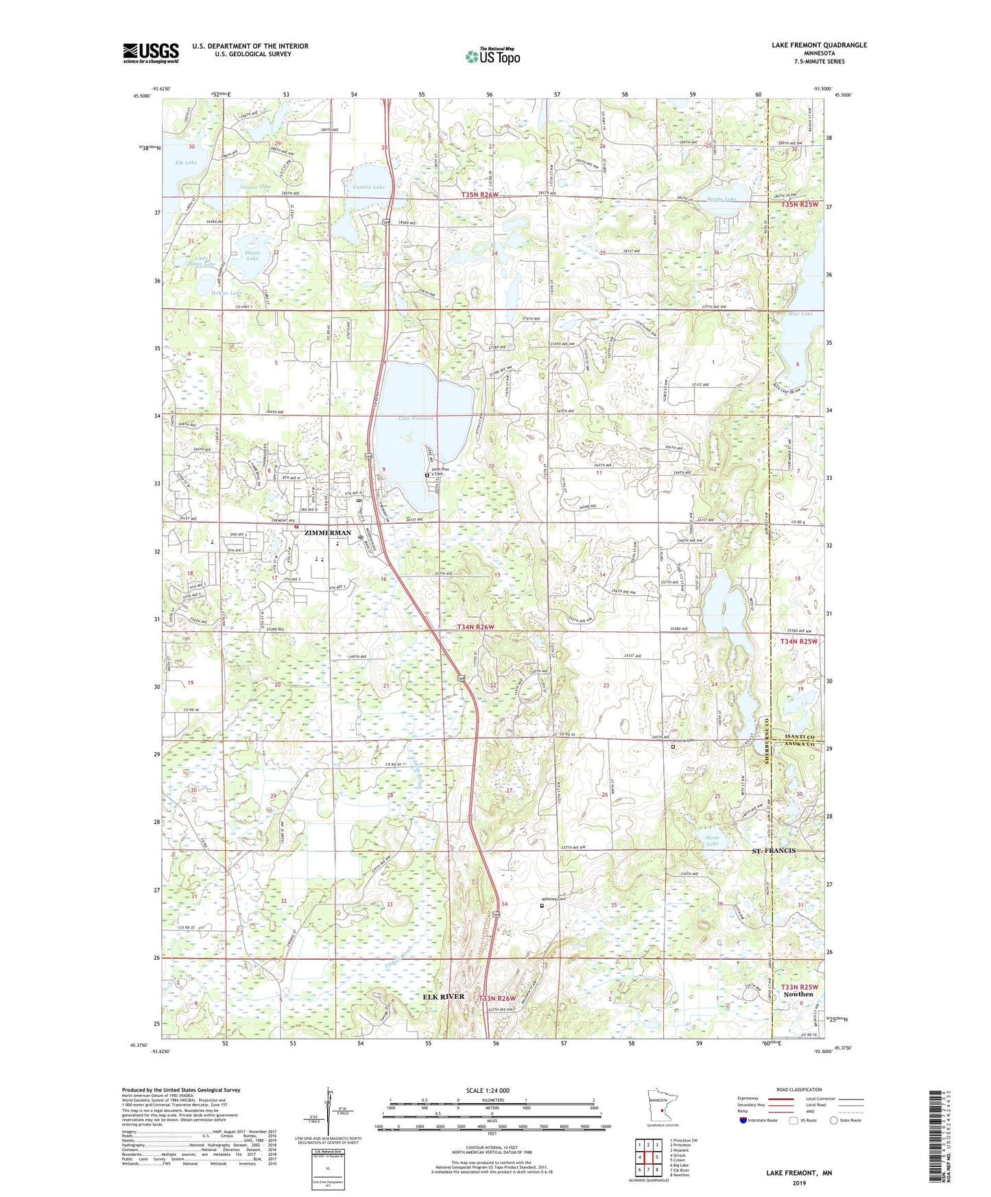
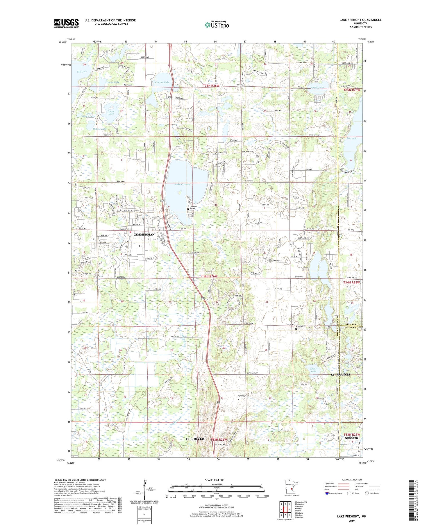
2019 topographic map quadrangle Lake Fremont in the state of Minnesota. Scale: 1:24000. Based on the newly updated USGS 7.5' US Topo map series, this map is in the following counties: Sherburne, Isanti, Anoka. The map contains contour data, water features, and other items you are used to seeing on USGS maps, but also has updated roads and other features. This is the next generation of topographic maps. Printed on high-quality waterproof paper with UV fade-resistant inks.
Quads adjacent to this one:
West: Orrock
Northwest: Princeton SW
North: Princeton
Northeast: Wyanett
East: Crown
Southeast: Nowthen
South: Elk River
Southwest: Big Lake
Contains the following named places: Blessed Cross Church, Blue Lake, Cantlin Lake, Church of God Prophecy, City of Zimmerman, Diann Lake, East Hunter Lake, Fairview Northland Clinic, Fairview Northland Regional Hospital, Faith Community Lutheran Church, Fremont Wildlife Management Area, Goose Lake, Helene Lake, Lake Fremont, Lake Fremont Seaplane Base, Little Diann Lake, Livonia Cemetery, Prairie Hill Lake, Rice Lake, Saint John Lutheran Church, Saint Pius X Catholic Church, Saint Pius X Cemetery, Sandy Lake, Stone Lake, Township of Livonia, West Hunter Lake, Whitney Cemetery, Zimmerman, Zimmerman City Hall, Zimmerman Elementary School, Zimmerman Evangelical Free Church, Zimmerman Fire Department, Zimmerman Middle School, Zimmerman Post Office, Zimmerman Terrace, ZIP Code: 55398