MyTopo
Orrock Minnesota US Topo Map
Couldn't load pickup availability
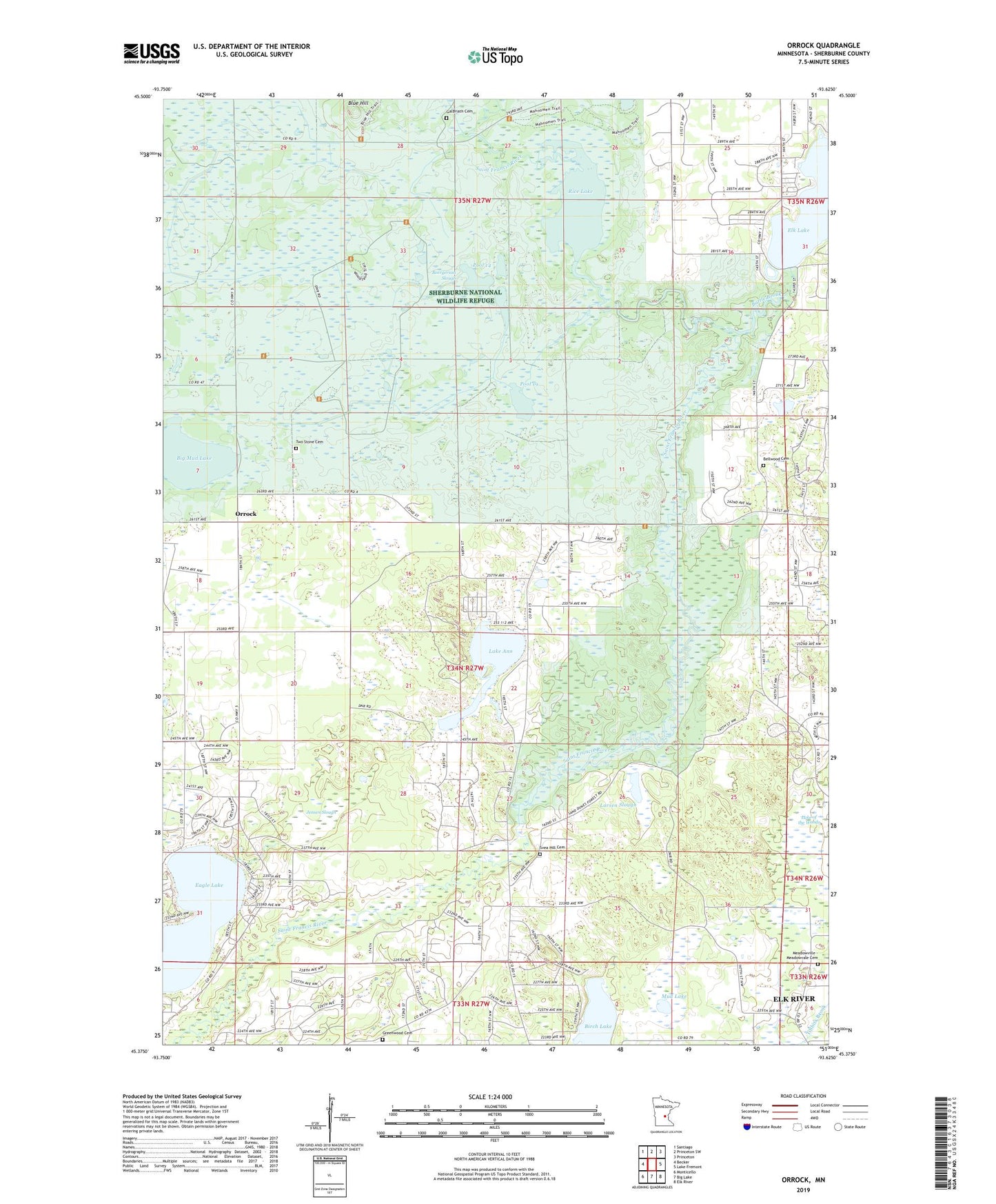
2022 topographic map quadrangle Orrock in the state of Minnesota. Scale: 1:24000. Based on the newly updated USGS 7.5' US Topo map series, this map is in the following counties: Sherburne. The map contains contour data, water features, and other items you are used to seeing on USGS maps, but also has updated roads and other features. This is the next generation of topographic maps. Printed on high-quality waterproof paper with UV fade-resistant inks.
Quads adjacent to this one:
West: Becker
Northwest: Santiago
North: Princeton SW
Northeast: Princeton
East: Lake Fremont
Southeast: Elk River
South: Big Lake
Southwest: Monticello
This map covers the same area as the classic USGS quad with code o45093d6.
Contains the following named places: Abundant Life Christian Center, Battle Brook, Beergerson Slough, Bellwood Cemetery, Big Mud Lake, Birch Lake, Blue Hill, Camp in the Woods, Community Covenant Church, Eagle Lake, Eidskog Church, Elk Lake, Galbriath Cemetery, Grace Assembly of God Church, Greenwood Cemetery, Jensen Slough, KXLI-TV (Saint Cloud), Lake Ann, Lake Josephine, Lake of the Woods, Larsen Slough, Meadowville - Meadowvale Cemetery, Mud Lake, Orrock, Orrock Church, Orrock Post Office, Pool 14, Pool 17, Pool 18, Pool 19, Pool 20, Pool 28, Pool 7, Rice Lake, Sand Dunes Lookout Tower, Sand Dunes State Forest, Sherburne National Wildlife Refuge, Sherburne National Wildlife Refuge Pool 14a Dam, Sherburne National Wildlife Refuge Pool 17 Dam, Sherburne National Wildlife Refuge Pool 18B Dam, Sherburne National Wildlife Refuge Pool 19 Dam, Sherburne National Wildlife Refuge Pool 20 Dam, Sherburne National Wildlife Refuge Pool 28 Dam, Sherburne National Wildlife Refuge Pool 7B Dam, Svea Hill Cemetery, Svea Hill Church, Township of Orrock, Two Stone Cemetery, ZIP Code: 55309