MyTopo
Lake Hanska West Minnesota US Topo Map
Couldn't load pickup availability
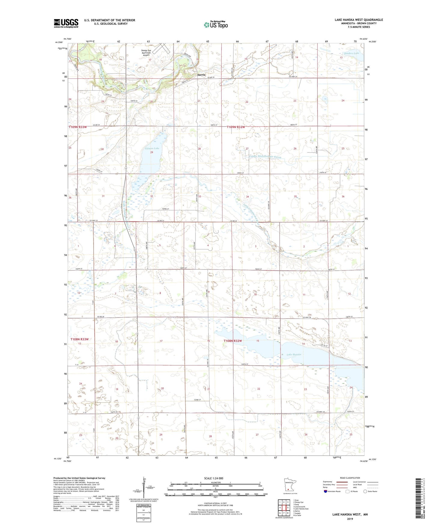
2019 topographic map quadrangle Lake Hanska West in the state of Minnesota. Scale: 1:24000. Based on the newly updated USGS 7.5' US Topo map series, this map is in the following counties: Brown. The map contains contour data, water features, and other items you are used to seeing on USGS maps, but also has updated roads and other features. This is the next generation of topographic maps. Printed on high-quality waterproof paper with UV fade-resistant inks.
Quads adjacent to this one:
West: Leavenworth
Northwest: Evan
North: Sleepy Eye
Northeast: Essig
East: Lake Hanska East
Southeast: La Salle
South: Godahl
Southwest: Darfur
Contains the following named places: Brown County, County Ditch Number Eleven, County Ditch Number Thirtythree, County Ditch Number Two, Gilman Lake, Iberia, Iberia Post Office, Quail Trap School, School Number 195, School Number 197, School Number 211, Stark, Township of Albin, Township of Stark, Zanders Lake