MyTopo
Essig Minnesota US Topo Map
Couldn't load pickup availability
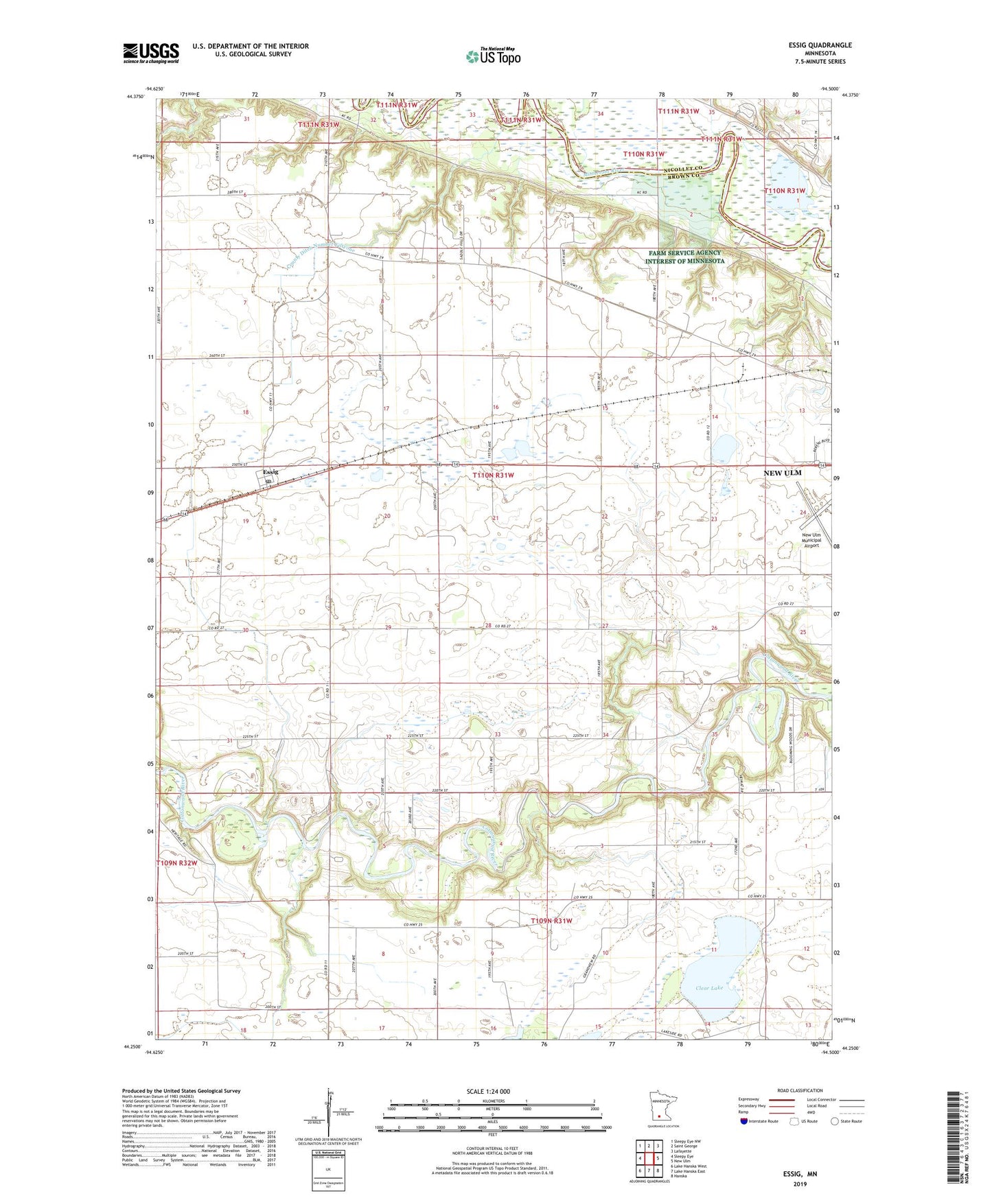
2022 topographic map quadrangle Essig in the state of Minnesota. Scale: 1:24000. Based on the newly updated USGS 7.5' US Topo map series, this map is in the following counties: Brown, Nicollet. The map contains contour data, water features, and other items you are used to seeing on USGS maps, but also has updated roads and other features. This is the next generation of topographic maps. Printed on high-quality waterproof paper with UV fade-resistant inks.
Quads adjacent to this one:
West: Sleepy Eye
Northwest: Sleepy Eye NW
North: Saint George
Northeast: Lafayette
East: New Ulm
Southeast: Hanska
South: Lake Hanska East
Southwest: Lake Hanska West
This map covers the same area as the classic USGS quad with code o44094c5.
Contains the following named places: Clear Lake, County Ditch Number Fiftyone, County Ditch Number One, County Ditch Number Three, Essig, Essig Ball Park, Essig Census Designated Place, Essig Post Office, Essig Trailer Court, Milford Monument, New Ulm Municipal Airport, School Number 179, School Number 181, School Number 182, School Number 186, School Number 213, Township of Milford