
MyTopo
Lake Itasca Minnesota US Topo Map
Couldn't load pickup availability
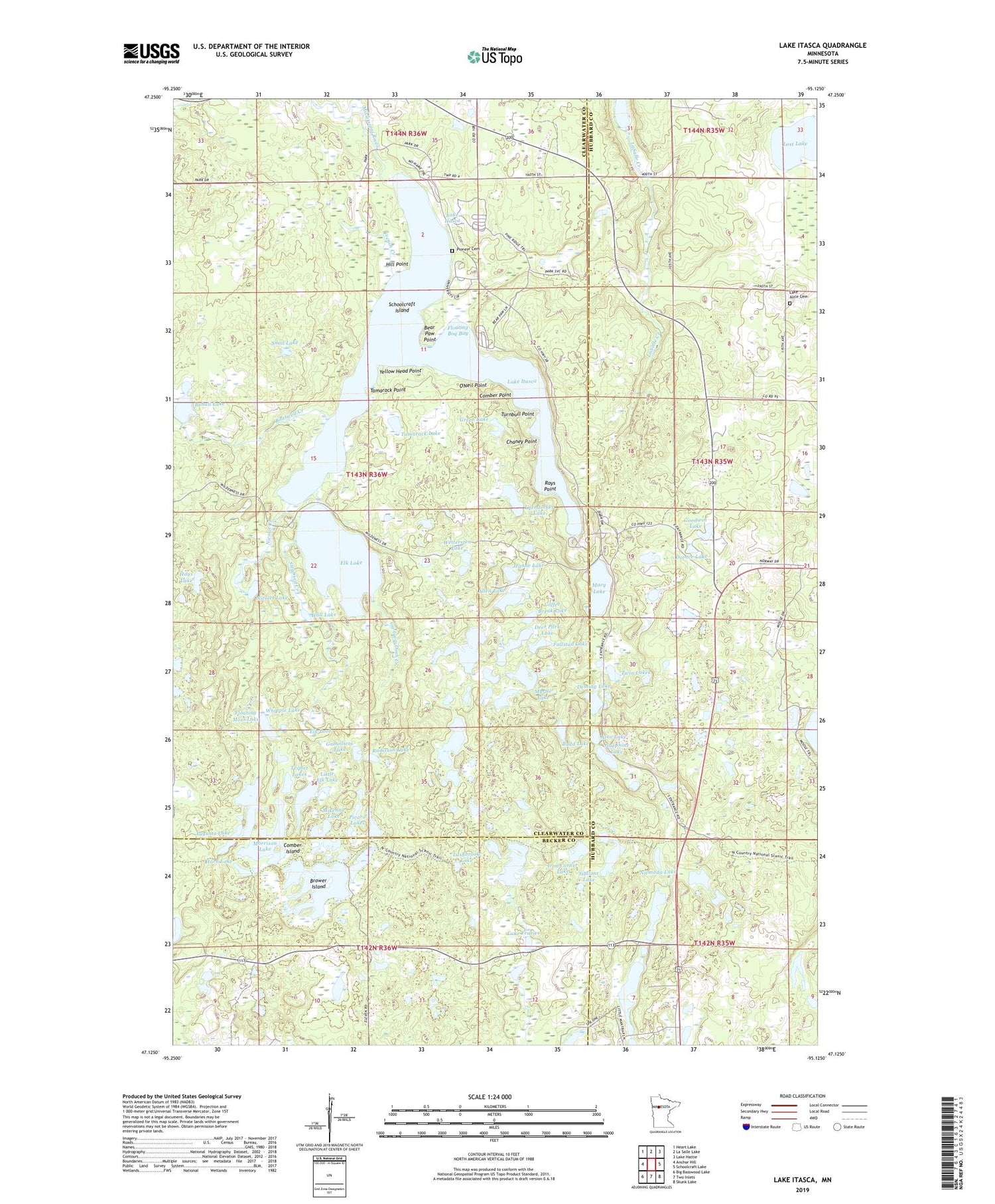
2019 topographic map quadrangle Lake Itasca in the state of Minnesota. Scale: 1:24000. Based on the newly updated USGS 7.5' US Topo map series, this map is in the following counties: Clearwater, Hubbard, Becker. The map contains contour data, water features, and other items you are used to seeing on USGS maps, but also has updated roads and other features. This is the next generation of topographic maps. Printed on high-quality waterproof paper with UV fade-resistant inks.
Quads adjacent to this one:
West: Anchor Hill
Northwest: Heart Lake
North: La Salle Lake
Northeast: Lake Hattie
East: Schoolcraft Lake
Southeast: Skunk Lake
South: Two Inlets
Southwest: Big Basswood Lake
Contains the following named places: Allen Lake, Alton Heights Lookout Tower, Arco Lake, Augusta Lake, Bear Paw Campground, Bear Paw Point, Bogus Lake, Bohall Lake, Boutwell Creek, Brower Island, Budd Lake, Chaney Point, Clarke Lake, Coffee Break Lake, Comber Island, Comber Point, Deer Park Lake, Deming Lake, Desoto Trail, Dorace Lake, Douglas Lodge Post Office, Eagle Scout Trail, East Arm Lake Itasca, Elk Lake, Elk Pool, Fallstad Lake, Floating Bog Bay, Floating Moss Lake, French Creek, Ga-Gwa-Dosh Creek, Geology of Minnesota Geological Marker, Gilfillan Lake, Goodwin Lake, Green Lake, Grosilliers Lake, Hall Lake, Hays Lake, Hernando DeSoto Lake, Hill Point, Horn Lake, Iron Corner Lake, Itasca State Park, Jeanne Lake, Josephine Lake, Lake Alice Cemetery, Lake Frazier, Lake Itasca, Lashbrook Lake, Little Elk Lake, Little Mantrap Lookout Tower, Lost Lake, Lyendecker Lake, Mary Lake, McKay Lake, Mikenna Lake, Morrison Lake, Myrtle Lake, Nicolet Creek, Nicolet Lake, Nicolet Trail, Niemada Lake, North Arm Lake Itasca, Old Northwest Territory Historical Marker, O'Neil Point, Picard Lakes, Pine Ridge Campground, Pioneer Cemetery, Radisson Lake, Rays Point, Reverend Joseph A Gilfillan Historical Marker, Schoolcraft Island, Search for the Mississippi's Source Historical Marker, Sibilant Lake, Siegfried Creek, Snail Lake, Tamarack Lake, Tamarack Point, Theodore and Johanna Wegmann Historical Marker, Triplet Lakes, Turnbull Point, Twin Lakes, University of Minnesota Forestry School, Unorganized Territory of South Clearwater, West Arm Lake Itasca, Wettersten Lake, Whipple Lake, Yellow Head Point


