MyTopo
La Salle Lake Minnesota US Topo Map
Couldn't load pickup availability
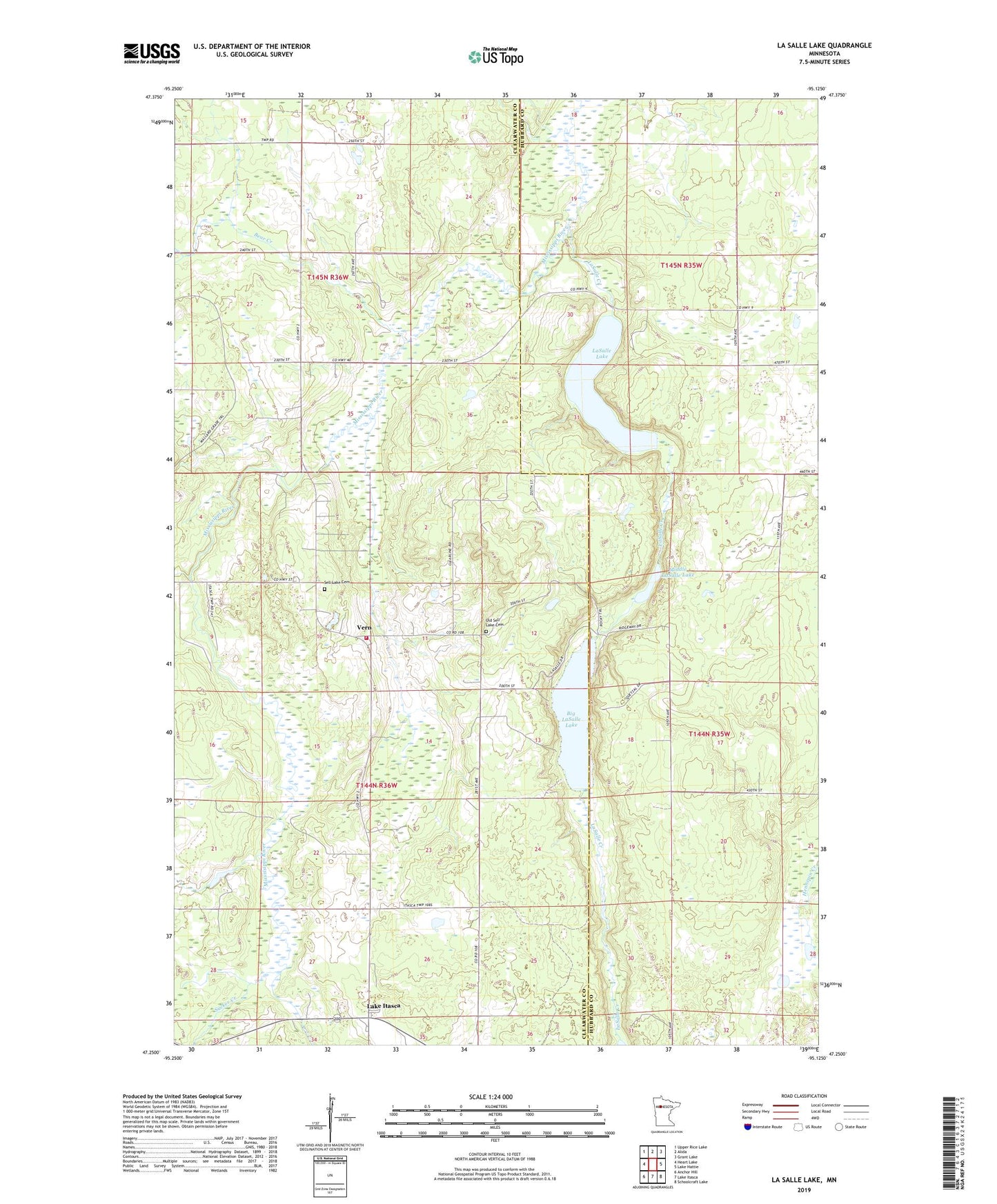
2022 topographic map quadrangle La Salle Lake in the state of Minnesota. Scale: 1:24000. Based on the newly updated USGS 7.5' US Topo map series, this map is in the following counties: Clearwater, Hubbard. The map contains contour data, water features, and other items you are used to seeing on USGS maps, but also has updated roads and other features. This is the next generation of topographic maps. Printed on high-quality waterproof paper with UV fade-resistant inks.
Quads adjacent to this one:
West: Heart Lake
Northwest: Upper Rice Lake
North: Alida
Northeast: Grant Lake
East: Lake Hattie
Southeast: Schoolcraft Lake
South: Lake Itasca
Southwest: Anchor Hill
This map covers the same area as the classic USGS quad with code o47095c2.
Contains the following named places: Bear Creek, Big LaSalle Lake, Coffee Pot Landing, Itasca Township Volunteer Fire Department, Lake Itasca, Lake Itasca Post Office, LaSalle Creek, LaSalle Lake, LaSalle Lookout Tower, Middle LaSalle Lake, Old Sell Lake Cemetery, Sell Lake Cemetery, Sell Lake Church, Sucker Creek, Township of Bear Creek, Township of Itasca, Vern, Vern Post Office