MyTopo
Lake Hattie Minnesota US Topo Map
Couldn't load pickup availability
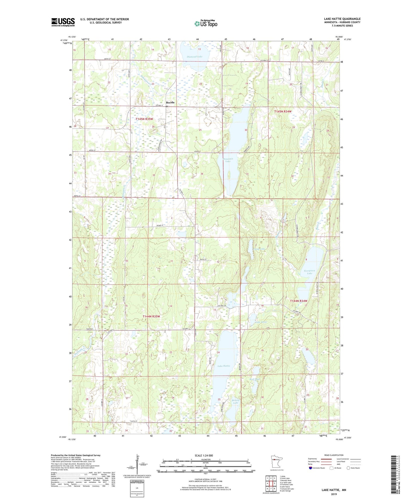
2022 topographic map quadrangle Lake Hattie in the state of Minnesota. Scale: 1:24000. Based on the newly updated USGS 7.5' US Topo map series, this map is in the following counties: Hubbard. The map contains contour data, water features, and other items you are used to seeing on USGS maps, but also has updated roads and other features. This is the next generation of topographic maps. Printed on high-quality waterproof paper with UV fade-resistant inks.
Quads adjacent to this one:
West: La Salle Lake
Northwest: Alida
North: Grant Lake
Northeast: Bemidji West
East: Frontenac Lake
Southeast: Lake George
South: Schoolcraft Lake
Southwest: Lake Itasca
This map covers the same area as the classic USGS quad with code o47095c1.
Contains the following named places: Beauty Lake, Becida, Becida Post Office, Camp Lake, Diamond Lake, Evergreen Lake, Fernhill Post Office, Hennepin Lake, Lake Emma, Lake Hattie, Lake Rosie, Lake Twenty, Skunk Creek, Township of Fern, Township of Lake Hattie, Wolf Lake