
MyTopo
Lake Lillian Minnesota US Topo Map
Couldn't load pickup availability
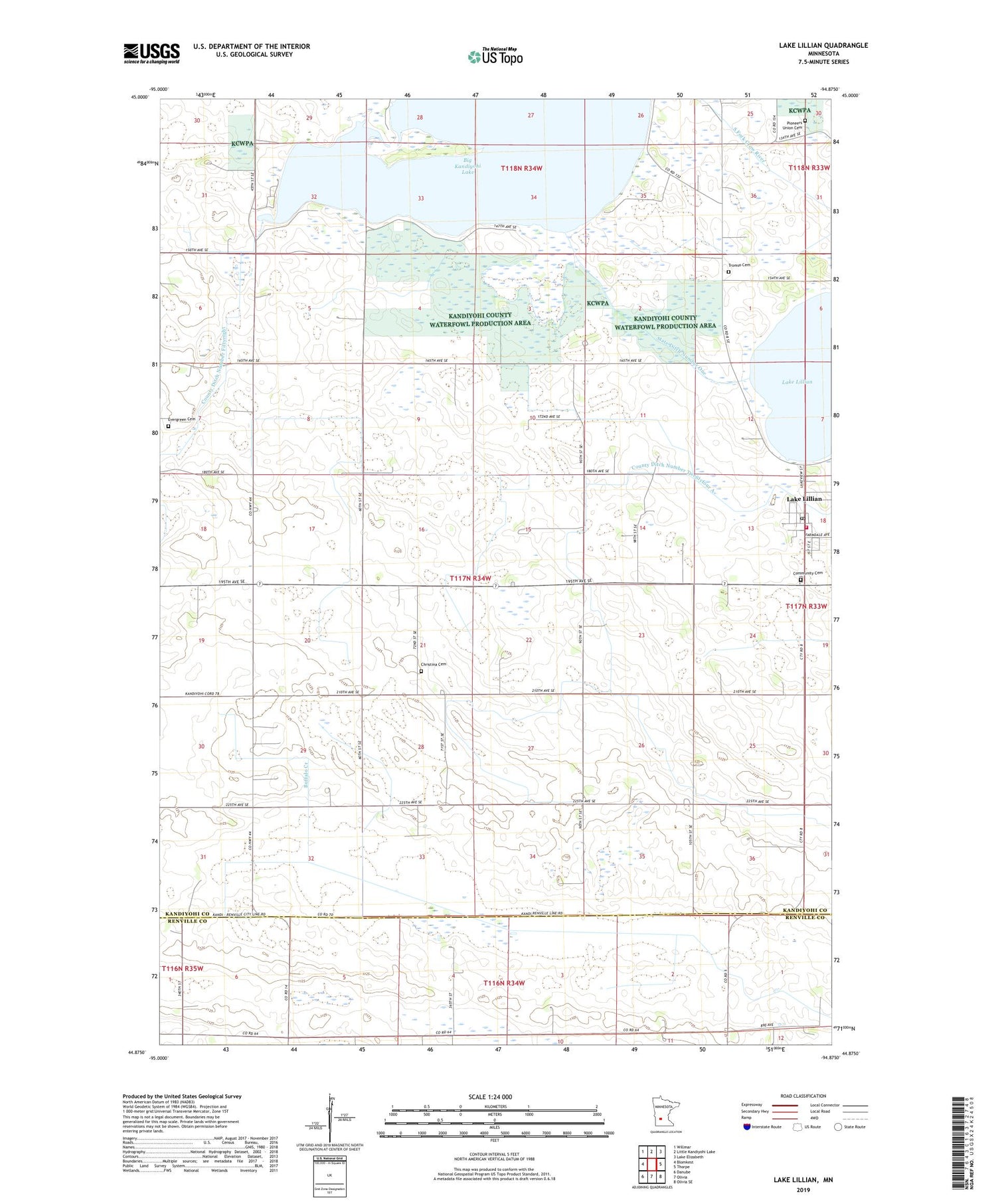
2019 topographic map quadrangle Lake Lillian in the state of Minnesota. Scale: 1:24000. Based on the newly updated USGS 7.5' US Topo map series, this map is in the following counties: Kandiyohi, Renville. The map contains contour data, water features, and other items you are used to seeing on USGS maps, but also has updated roads and other features. This is the next generation of topographic maps. Printed on high-quality waterproof paper with UV fade-resistant inks.
Quads adjacent to this one:
West: Blomkest
Northwest: Willmar
North: Little Kandiyohi Lake
Northeast: Lake Elizabeth
East: Thorpe
Southeast: Olivia SE
South: Olivia
Southwest: Danube
Contains the following named places: Big Kandiyohi Lake, Christina Cemetery, City of Lake Lillian, Community Cemetery, County Ditch Number Fiftyeight, County Ditch Number Twentyfour A, County Park Number One, Eagle Lake, Eagle Lake Dam, Evergreen Cemetery, First Lutheran Church, Free Church, Judicial Ditch Number Two, Lake Lillian, Lake Lillian City Park, Lake Lillian Fire Department, Lake Lillian Library, Lake Lillian Lutheran Parish, Lake Lillian Post Office, Luce Line State Trail, Pioneers Union Cemetery, Saint Thomas More Catholic Church, State Ditch Number One, Township of Lake Lillian, Tromso Cemetery


