MyTopo
Thorpe Minnesota US Topo Map
Couldn't load pickup availability
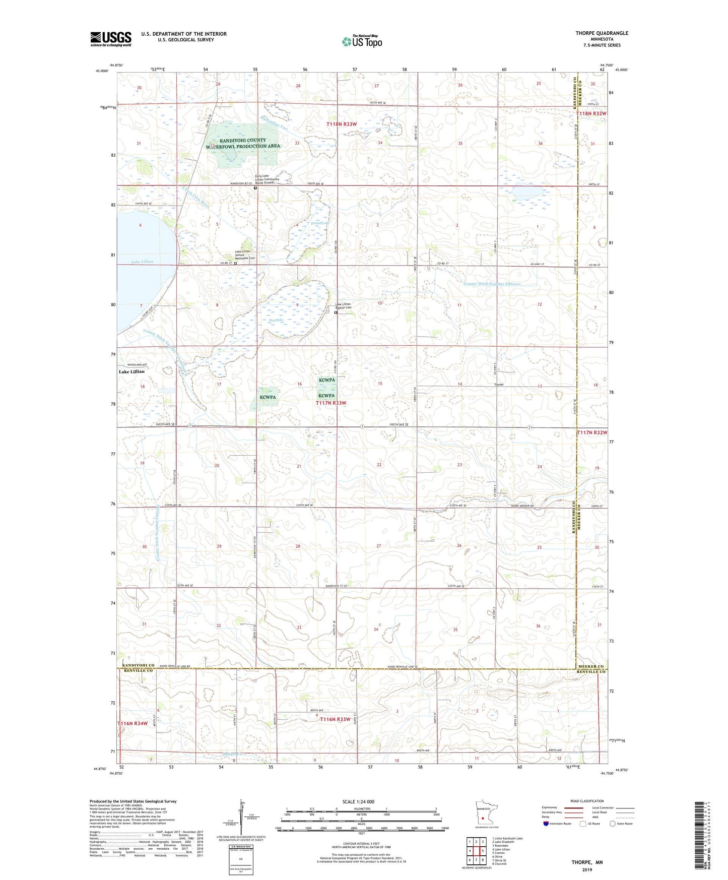
2022 topographic map quadrangle Thorpe in the state of Minnesota. Scale: 1:24000. Based on the newly updated USGS 7.5' US Topo map series, this map is in the following counties: Kandiyohi, Renville, Meeker. The map contains contour data, water features, and other items you are used to seeing on USGS maps, but also has updated roads and other features. This is the next generation of topographic maps. Printed on high-quality waterproof paper with UV fade-resistant inks.
Quads adjacent to this one:
West: Lake Lillian
Northwest: Little Kandiyohi Lake
North: Lake Elizabeth
Northeast: Rosendale
East: Cosmos
Southeast: Churchill
South: Olivia SE
Southwest: Olivia
This map covers the same area as the classic USGS quad with code o44094h7.
Contains the following named places: County Ditch Number Fiftyone, County Ditch Number Fiftytwo, Dog Lake, Double A Farms, Early Lake Lillian Community Burial Ground, Emma Lake, Judicial Ditch Number Twentynine, Lake Lillian Baptist Cemetery, Lake Lillian Church, Lake Lillian United Methodist Cemetery, Thorpe, Thorpe Post Office, Township of East Lake Lillian, ZIP Code: 56253