
MyTopo
Laporte Minnesota US Topo Map
Couldn't load pickup availability
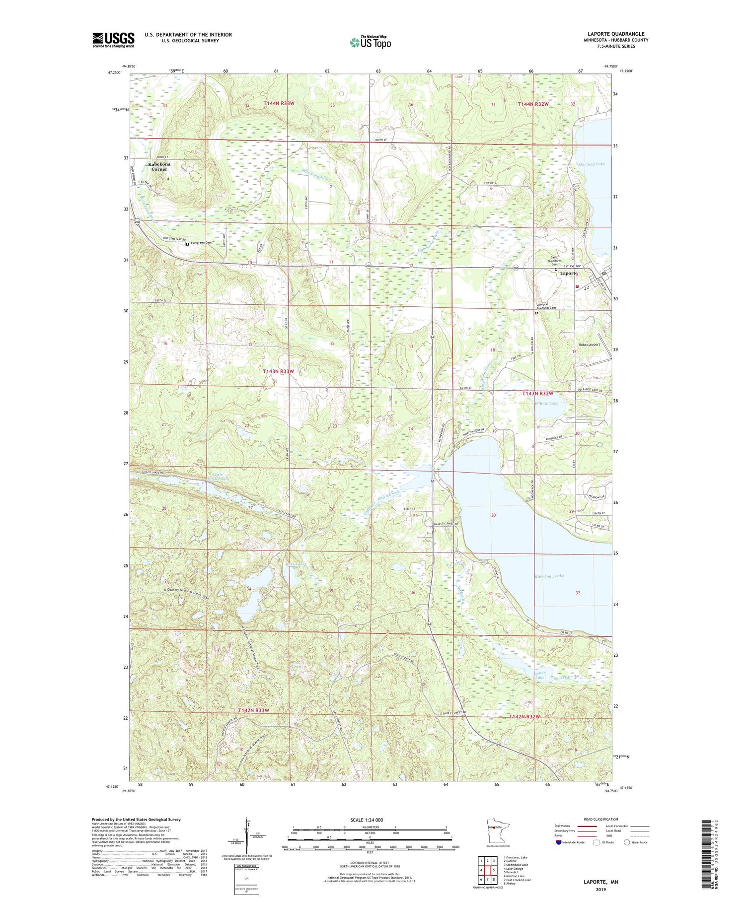
2019 topographic map quadrangle Laporte in the state of Minnesota. Scale: 1:24000. Based on the newly updated USGS 7.5' US Topo map series, this map is in the following counties: Hubbard. The map contains contour data, water features, and other items you are used to seeing on USGS maps, but also has updated roads and other features. This is the next generation of topographic maps. Printed on high-quality waterproof paper with UV fade-resistant inks.
Quads adjacent to this one:
West: Lake George
Northwest: Frontenac Lake
North: Guthrie
Northeast: Steamboat Lake
East: Benedict
Southeast: Akeley
South: East Crooked Lake
Southwest: Mantrap Lake
Contains the following named places: Bass Lakes, Christ Gospel Church, City of Laporte, Evergreen Cemetery, Gulch Creek, Kabekona Community Church, Kabekona Free Methodist Church, Kabekona Lake, Kabekona River, Lake Twentyone, Lakeport Township Cemetery, Lakeport Volunteer Fire and Rescue, Laporte, Laporte Community Baptist Church, Laporte Lutheran Church, Laporte Post Office, Lester Lake, Little Gulch Lakes, Robco Airport, Saint Theodore's Catholic Church, Saint Theodores Cemetery, Sucker Branch, Township of Hendrickson, Trinity Lutheran Church, Willow Lake, ZIP Code: 56461


