MyTopo
Lawrence Lake West Minnesota US Topo Map
Couldn't load pickup availability
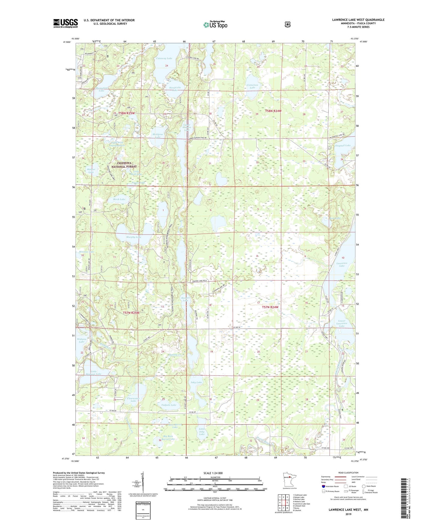
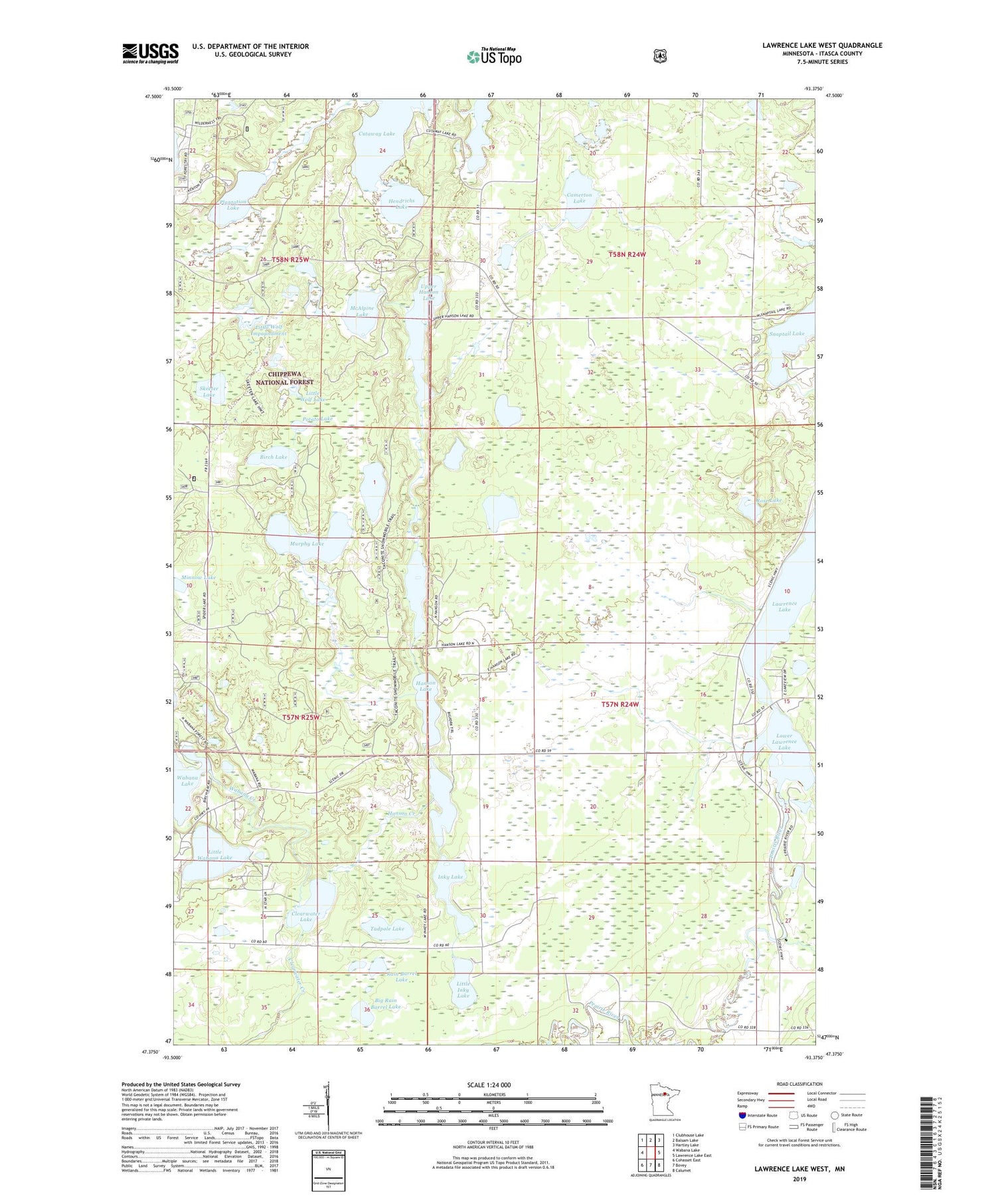
2019 topographic map quadrangle Lawrence Lake West in the state of Minnesota. Scale: 1:24000. Based on the newly updated USGS 7.5' US Topo map series, this map is in the following counties: Itasca. The map contains contour data, water features, and other items you are used to seeing on USGS maps, but also has updated roads and other features. This is the next generation of topographic maps. Printed on high-quality waterproof paper with UV fade-resistant inks.
Quads adjacent to this one:
West: Wabana Lake
Northwest: Clubhouse Lake
North: Balsam Lake
Northeast: Hartley Lake
East: Lawrence Lake East
Southeast: Calumet
South: Bovey
Southwest: Cohasset East
Contains the following named places: Arrowhead Lake, Big Rain Barrel Lake, Birch Lake, Camerton Lake, Clearwater Lake, Cutaway Lake, Hanson Creek, Hanson Lake, Hanson Lake Impoundment, Hendrichs Lake, Inky Lake, Lawrence Lake, Lawron Chapel, Little Inky Lake, Little Wabana Lake, Little Wolf Impoundment, Little Wolf Lake, Little Wolf Lake Wildlife Impondment Dam, Lower Hanson Lake, Lower Lawrence Lake, McAlpine Lake, Middle Hanson Lake, Minnow Lake, Murphy Lake, Plantation Lake, Potato Lake, Rain Barrel Lake, Rose Lake, Shaughnessy Seaplane Base, Skeeter Lake, Skeeter Lake Trail System, Snaptail Lake, Sucker Brook, Tadpole Lake, Township of Lawrence, Upper Hanson Lake, Wabana Creek, Wabana Lake, Wabana Lake Dam, Wabana Lake Post Office, Wabana Post Office