MyTopo
Cohasset East Minnesota US Topo Map
Couldn't load pickup availability
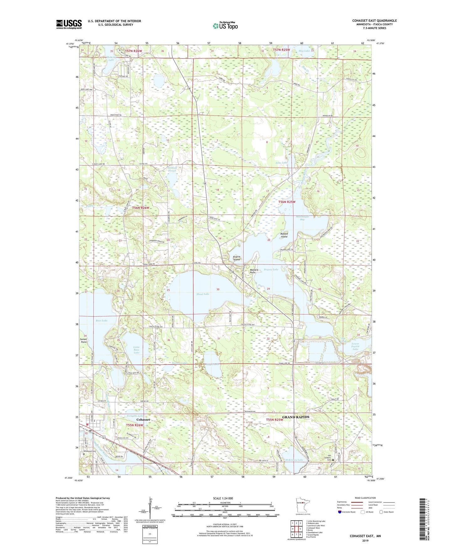
2022 topographic map quadrangle Cohasset East in the state of Minnesota. Scale: 1:24000. Based on the newly updated USGS 7.5' US Topo map series, this map is in the following counties: Itasca. The map contains contour data, water features, and other items you are used to seeing on USGS maps, but also has updated roads and other features. This is the next generation of topographic maps. Printed on high-quality waterproof paper with UV fade-resistant inks.
Quads adjacent to this one:
West: Cohasset West
Northwest: Little Bowstring Lake
North: Wabana Lake
Northeast: Lawrence Lake West
East: Bovey
Southeast: La Prairie
South: Grand Rapids
Southwest: Siseebakwet Lake
This map covers the same area as the classic USGS quad with code o47093c5.
Contains the following named places: Arbo Lake, Bass Brook, Bass Brook Court, Cohasset, Cohasset Elementary School, Cohasset Fire and Rescue, Cohasset Post Office, Community Bible Chapel, Dethloff Slough, Forsythe Lake, Greenway Mine, Hay Creek, Hay Lake, Horseshoe Lake, Lind Greenway Dike, Lind Greenway Tailings Basin, Little Bass Lake, Lower Prairie Lake, MacDougal Bay, Mallard Point, Mankie Island, McAvity Lake, McKinney Lake, Nagel Lake, Old Soldiers Cemetery, Our Redeemer Lutheran Church, Prairie Island, Prairie Lake, Prarie Lake Campground, Richter Ranch Airport, Saint Andrews Lutheran Church, Saint Augustine Church, Shoal Lake, Stevens Lake, The Gorge, Township of Arbo, Wildwood Cemetery