
MyTopo
Little Kandiyohi Lake Minnesota US Topo Map
Couldn't load pickup availability
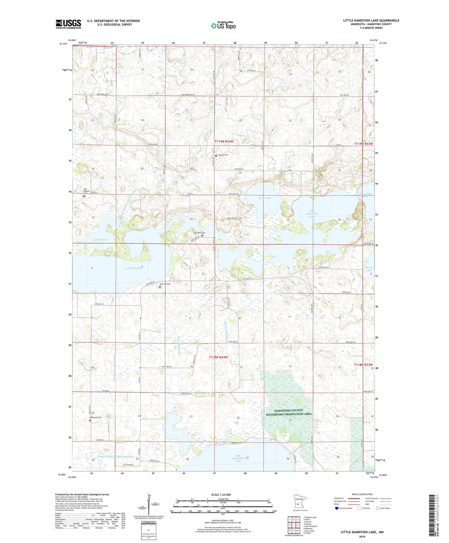
2019 topographic map quadrangle Little Kandiyohi Lake in the state of Minnesota. Scale: 1:24000. Based on the newly updated USGS 7.5' US Topo map series, this map is in the following counties: Kandiyohi. The map contains contour data, water features, and other items you are used to seeing on USGS maps, but also has updated roads and other features. This is the next generation of topographic maps. Printed on high-quality waterproof paper with UV fade-resistant inks.
Quads adjacent to this one:
West: Willmar
Northwest: Solomon Lake
North: Spicer
Northeast: Atwater
East: Lake Elizabeth
Southeast: Thorpe
South: Lake Lillian
Southwest: Blomkest
Contains the following named places: Bethesda Cemetery, Big Kandiyohi Channel, Branch Number Four, Cherry Lake, County Ditch Number Sixtyfour, County Ditch Number Twentythree A, County Park Number Two, Fanny Lake, Judicial Ditch Number One, Kandiyohi Lake, Kandiyohi Lake Inlet Dam, Kandiyohi Methodist Episcopal Church, Kasota Lake, Lake Eleanor, Lake Wakanda, Little Kandiyohi Lake, Little Kandiyohi Lake Dam, Oak Hill Cemetery, Oak Park Cemetery, Oak Park Church, Old Baptist Cemetery, School Number 39, School Number 61, School Number 68, School Number 79, Swan Lake, Township of Fahlun, Township of Kandiyohi, Tripolis Cemetery, Tripolis Church


