
MyTopo
Little Marais Minnesota US Topo Map
Couldn't load pickup availability
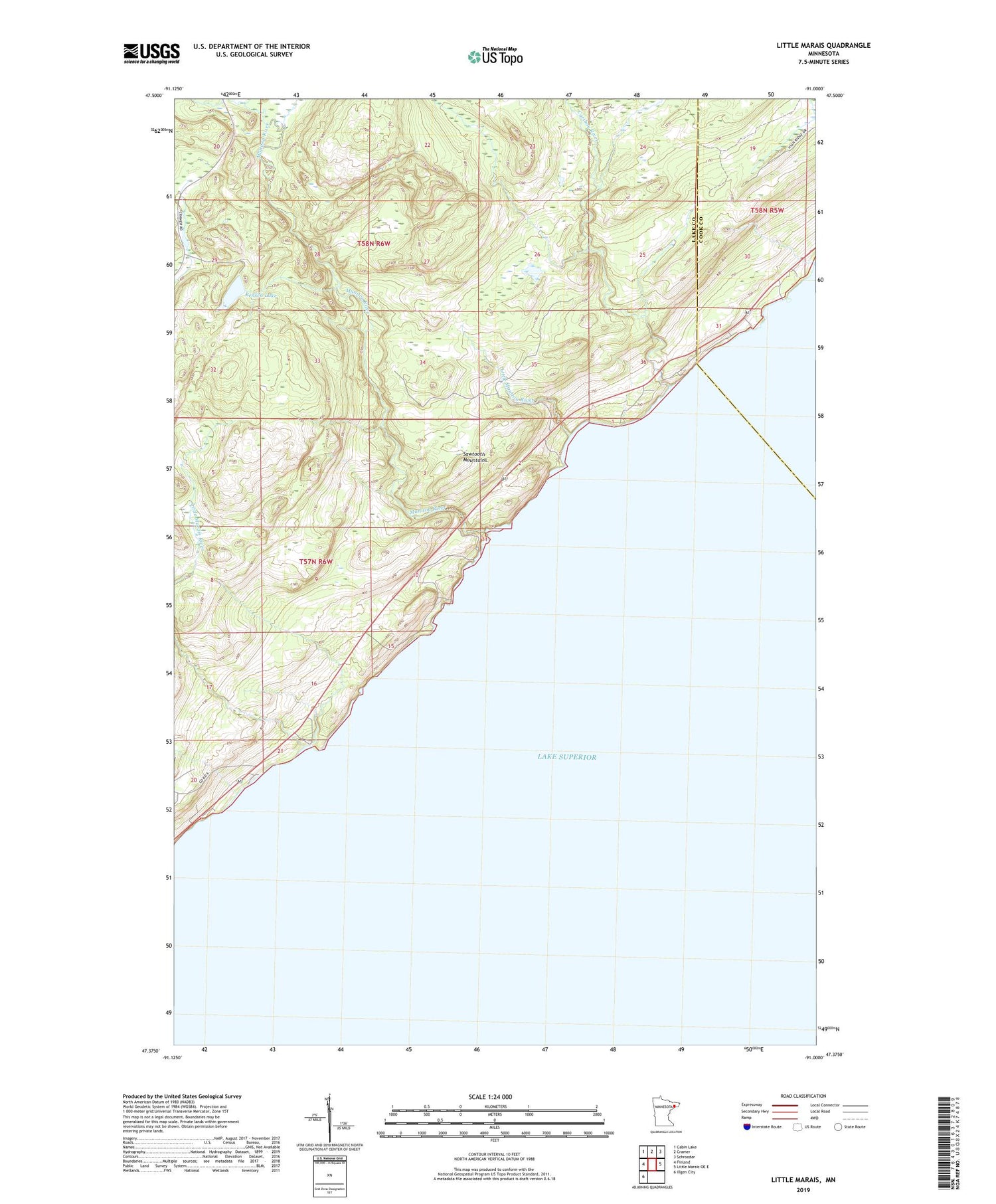
2019 topographic map quadrangle Little Marais in the state of Minnesota. Scale: 1:24000. Based on the newly updated USGS 7.5' US Topo map series, this map is in the following counties: Lake, Cook. The map contains contour data, water features, and other items you are used to seeing on USGS maps, but also has updated roads and other features. This is the next generation of topographic maps. Printed on high-quality waterproof paper with UV fade-resistant inks.
Quads adjacent to this one:
West: Finland
Northwest: Cabin Lake
North: Cramer
Northeast: Schroeder
East: Little Marais OE E
Southwest: Illgen City
Contains the following named places: Bensen Lake, Caribou Falls, Caribou River, Little Manitou River, Little Marais, Little Marais River, Manitou River, Pork Bay


