MyTopo
Schroeder Minnesota US Topo Map
Couldn't load pickup availability
Also explore the Schroeder Forest Service Topo of this same quad for updated USFS data
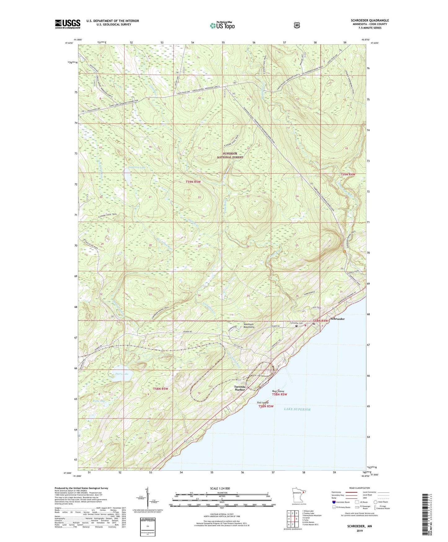
2022 topographic map quadrangle Schroeder in the state of Minnesota. Scale: 1:24000. Based on the newly updated USGS 7.5' US Topo map series, this map is in the following counties: Cook. The map contains contour data, water features, and other items you are used to seeing on USGS maps, but also has updated roads and other features. This is the next generation of topographic maps. Printed on high-quality waterproof paper with UV fade-resistant inks.
Quads adjacent to this one:
West: Cramer
Northwest: Wilson Lake
North: Toohey Lake
Northeast: Honeymoon Mountain
East: Tofte
South: Little Marais OE E
Southwest: Little Marais
This map covers the same area as the classic USGS quad with code o47090e8.
Contains the following named places: Bear Island, Cross River, Cross River Wayside Rest Area, Dogwood Lake, Dyers Lake, Father Baraga's Cross Historical Marker, Fredenberg Creek, Gull Island, Heartbreak Creek, Lamb's Campground and Resort, Lamb's Mobile Home Park, Ruffy Lake, Schroeder, Schroeder Cemetery, Schroeder Post Office, Schroeder Volunteer Fire Department, Stumble Creek, Taconite Harbor, Taconite Harbor Recreation Site, Two Island River, ZIP Code: 55613