MyTopo
Lonsdale Minnesota US Topo Map
Couldn't load pickup availability
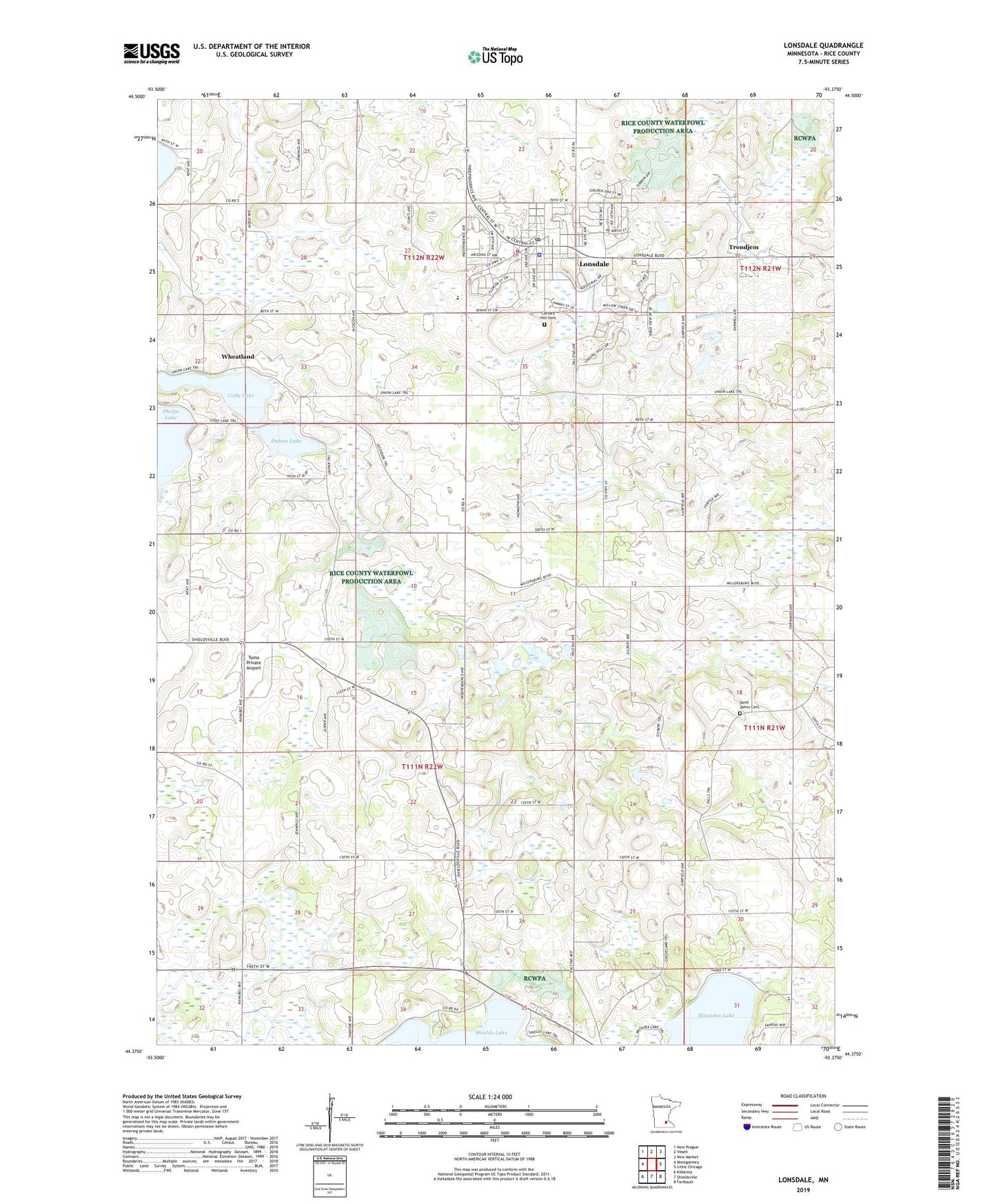
2019 topographic map quadrangle Lonsdale in the state of Minnesota. Scale: 1:24000. Based on the newly updated USGS 7.5' US Topo map series, this map is in the following counties: Rice. The map contains contour data, water features, and other items you are used to seeing on USGS maps, but also has updated roads and other features. This is the next generation of topographic maps. Printed on high-quality waterproof paper with UV fade-resistant inks.
Quads adjacent to this one:
West: Montgomery
Northwest: New Prague
North: Veseli
Northeast: New Market
East: Little Chicago
Southeast: Faribault
South: Shieldsville
Southwest: Kilkenny
Contains the following named places: Calvary Hill Cemetery, City of Lonsdale, Cody Lake, Doctor John Komarek Dam, Duban Lake, Lonsdale, Lonsdale Elementary School, Lonsdale Fire Department, Lonsdale Police Department, Lonsdale Post Office, Meehl School, Pleasant View School, Quinlan School, Rice County Waterfowl Production Area, Saint Johns Cemetery, School Number 1794, School Number 1829, Township of Erin, Trondjem, Trondjem Church, Tuma Private Airport, Wadecamper School, Wheatland, ZIP Code: 55046