MyTopo
Kilkenny Minnesota US Topo Map
Couldn't load pickup availability
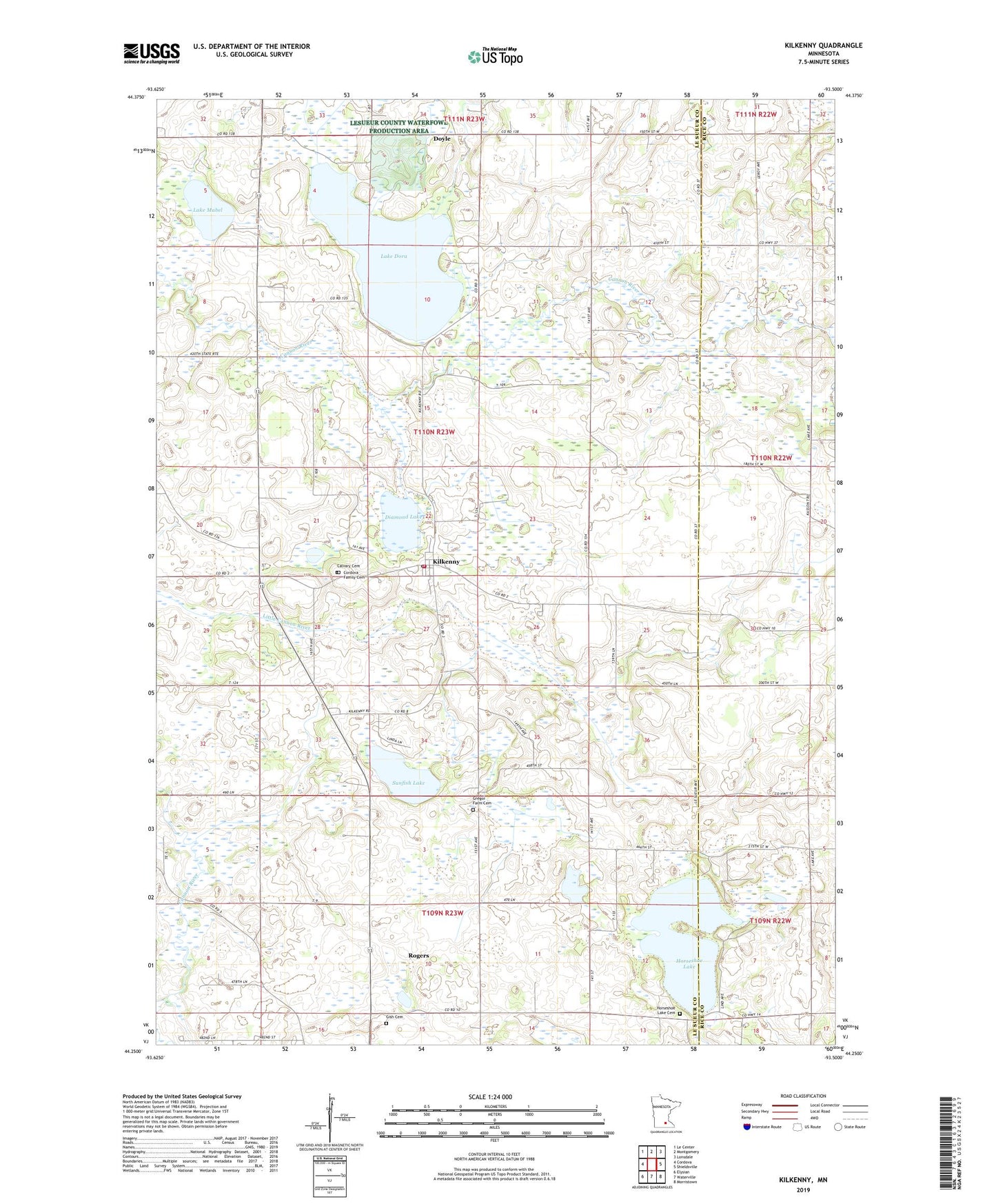
2022 topographic map quadrangle Kilkenny in the state of Minnesota. Scale: 1:24000. Based on the newly updated USGS 7.5' US Topo map series, this map is in the following counties: Le Sueur, Rice. The map contains contour data, water features, and other items you are used to seeing on USGS maps, but also has updated roads and other features. This is the next generation of topographic maps. Printed on high-quality waterproof paper with UV fade-resistant inks.
Quads adjacent to this one:
West: Cordova
Northwest: Le Center
North: Montgomery
Northeast: Lonsdale
East: Shieldsville
Southeast: Morristown
South: Waterville
Southwest: Elysian
This map covers the same area as the classic USGS quad with code o44093c5.
Contains the following named places: Calvary Cemetery, Church of Saint Canice, City of Kilkenny, Cordova Family Cemetery, County Ditch Number Fifteen, County Ditch Number Fiftyseven, County Ditch Number Forty, County Ditch Number Sixtysix, Diamond Lake, Diamond Lake State Wildlife Management Ar, Doyle, Doyle Post Office, Gish Cemetery, Gishville, Gishville School, Goose Lake, Gregor Farm Cemetery, Horseshoe Lake, Horseshoe Lake Cemetery, Kilkenny, Kilkenny Fire Department, Kilkenny Post Office, Kilkenny Public Library, Lake Dora, Lake Mabel, Lesueur County Waterfowl Production Area, Madden's Orchard, Murphy State Wildlife Management Area, Rogers, Sunfish Lake, Township of Kilkenny, United Brethren Church, ZIP Code: 56052