MyTopo
Faribault Minnesota US Topo Map
Couldn't load pickup availability
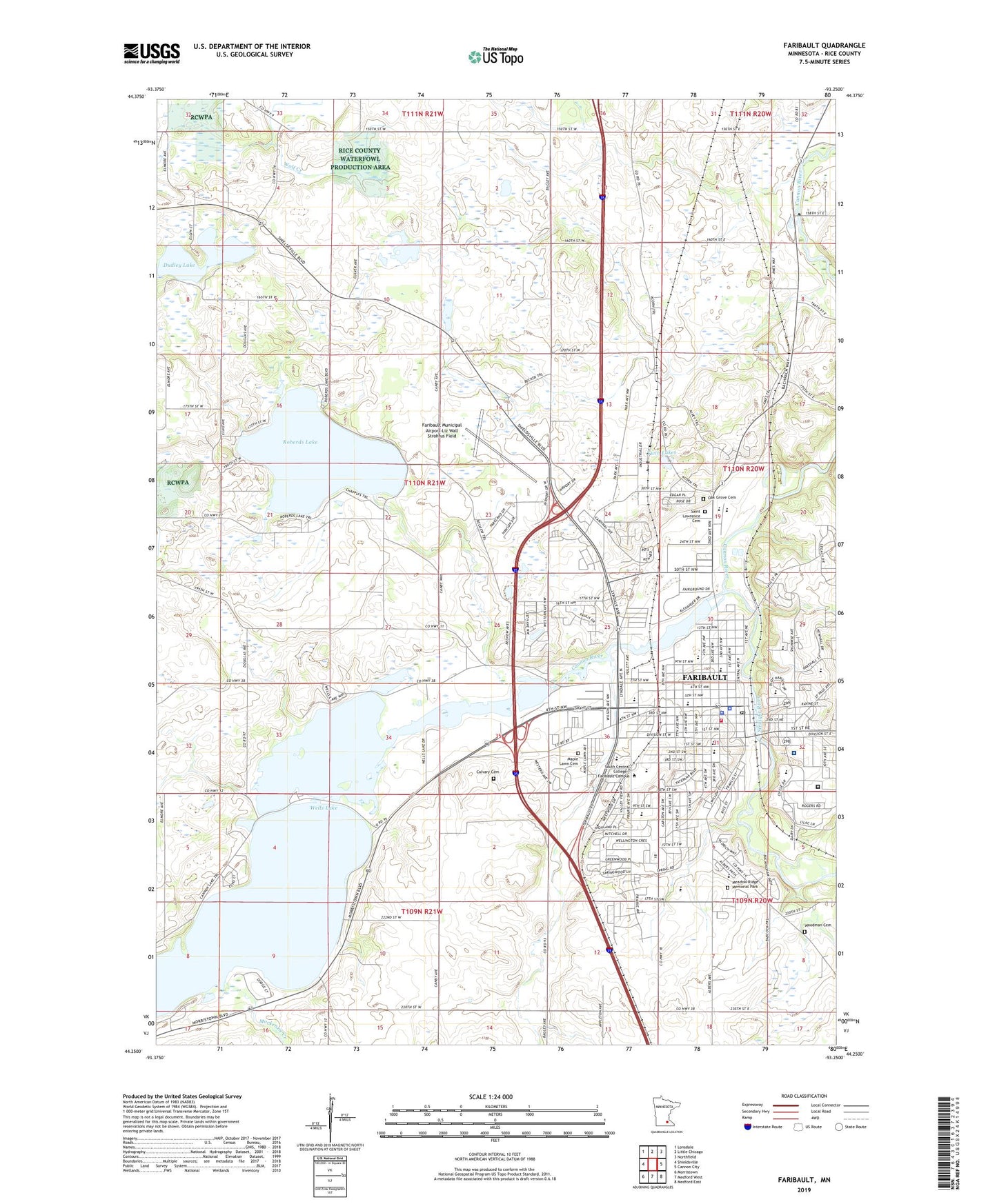
2022 topographic map quadrangle Faribault in the state of Minnesota. Scale: 1:24000. Based on the newly updated USGS 7.5' US Topo map series, this map is in the following counties: Rice. The map contains contour data, water features, and other items you are used to seeing on USGS maps, but also has updated roads and other features. This is the next generation of topographic maps. Printed on high-quality waterproof paper with UV fade-resistant inks.
Quads adjacent to this one:
West: Shieldsville
Northwest: Lonsdale
North: Little Chicago
Northeast: Northfield
East: Cannon City
Southeast: Medford East
South: Medford West
Southwest: Morristown
This map covers the same area as the classic USGS quad with code o44093c3.
Contains the following named places: Bethlehem Academy, Calvary Cemetery, Cannon Lake, Cannon Lake School, Cannon River Dam, Cannon River Reservoir, City of Faribault, District One Hospital, District One Hospital Heliport, Divine Mercy Catholic School - North Campus, Divine Mercy Catholic School - South Campus, Dudley Lake, Dudley Lake School, Fair View School, Faribault, Faribault Fire Department, Faribault High School, Faribault Lutheran School - Peace Campus, Faribault Lutheran School - Trinity Campus, Faribault Middle School, Faribault Municipal Airport-Liz Wall Strohfus Field, Faribault Park, Faribault Police Department, Faribault Post Office, Garfield School, Jefferson Elementary School, Jewett Valley School, KDHL-AM (Faribault), Kelly Lake, Kings Mill Dam, La Croix School, Langer Dairy, Lincoln Elementary School, Mackenzie Creek, Maple Lawn Cemetery, McKinley Early Childhood Center, Meadow Ridge Memorial Park, Minnesota Correctional Facility Faribault, Minnesota State Academy for the Blind, Minnesota State Academy for the Deaf, North Grove Church, North Memorial Ambulance - Faribault Region, Oak Ridge Cemetery, Parkside Seventh Day Adventist Elementary School, Peace School, Rice County, Rice County Sheriff, Roberds Lake, Roberds Lake School, Roosevelt Elementary School, Saint James School, Saint Lawrence Cemetery, Saint Marys School, School Number 1778, Shattuck - Saint Mary's School - Middle School Campus, Shattuck - Saint Mary's School - Upper School Campus, Shattuck School, South Central College - Faribault Campus, State Academy for the Deaf, Straight River, Tonka Park, Township of Wells, Twin Lakes, Wapacuta Park, Washington School, Wells Lake, Wilson Academy, Woodman Cemetery, ZIP Code: 55021