
MyTopo
Lynd Minnesota US Topo Map
Couldn't load pickup availability
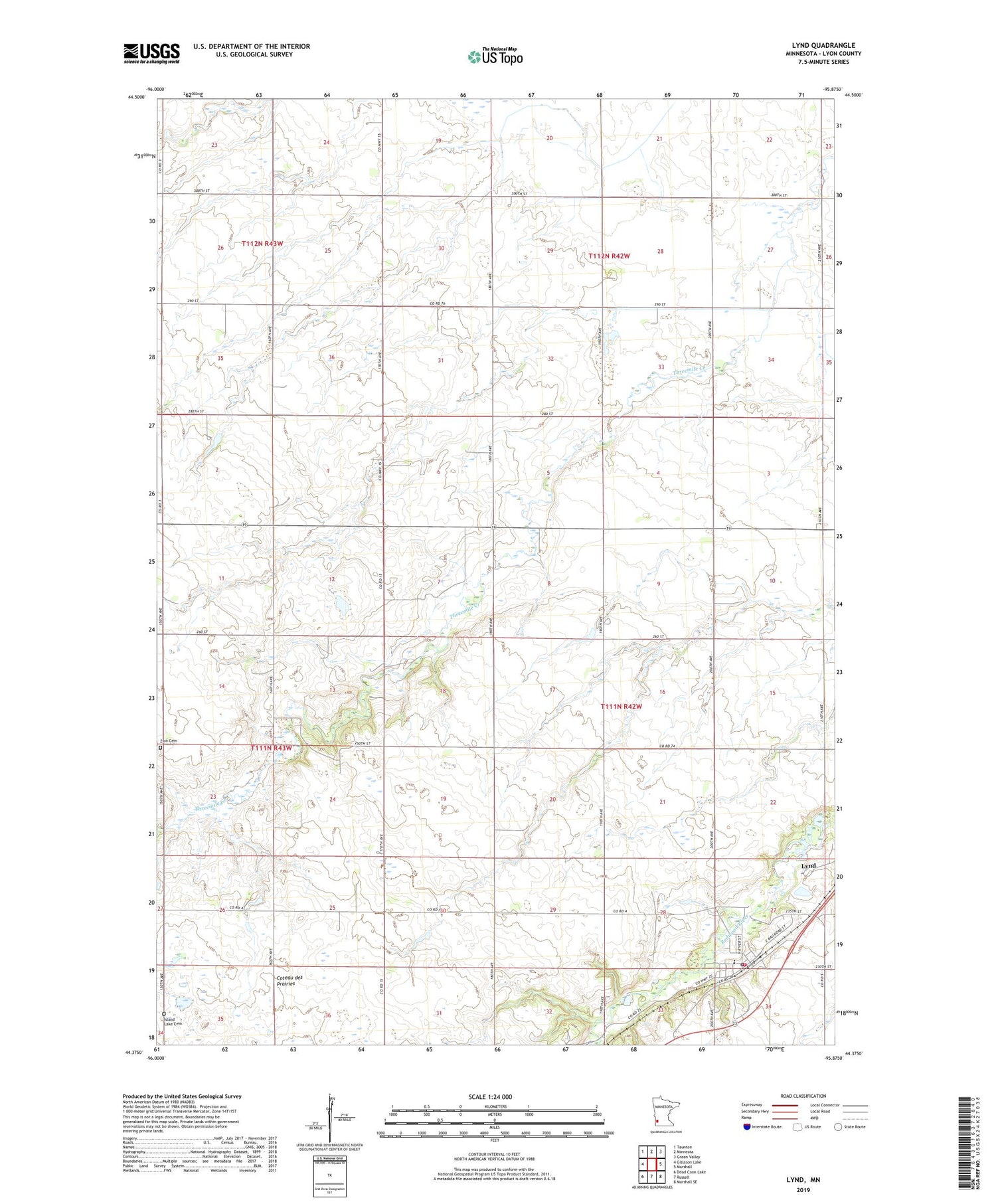
2019 topographic map quadrangle Lynd in the state of Minnesota. Scale: 1:24000. Based on the newly updated USGS 7.5' US Topo map series, this map is in the following counties: Lyon. The map contains contour data, water features, and other items you are used to seeing on USGS maps, but also has updated roads and other features. This is the next generation of topographic maps. Printed on high-quality waterproof paper with UV fade-resistant inks.
Quads adjacent to this one:
West: Gislason Lake
Northwest: Taunton
North: Minneota
Northeast: Green Valley
East: Marshall
Southeast: Marshall SE
South: Russell
Southwest: Dead Coon Lake
Contains the following named places: City of Lynd, Island Lake Cemetery, Lynd, Lynd City Hall, Lynd Elementary School, Lynd Fire Department and Ambulance Service, Lynd Junior High School, Lynd Mobile Home Park, Lynd Post Office, Runholt-Mellenthin Dam, Township of Lynd, Zion Cemetery, ZIP Code: 56157


