MyTopo
Taunton Minnesota US Topo Map
Couldn't load pickup availability
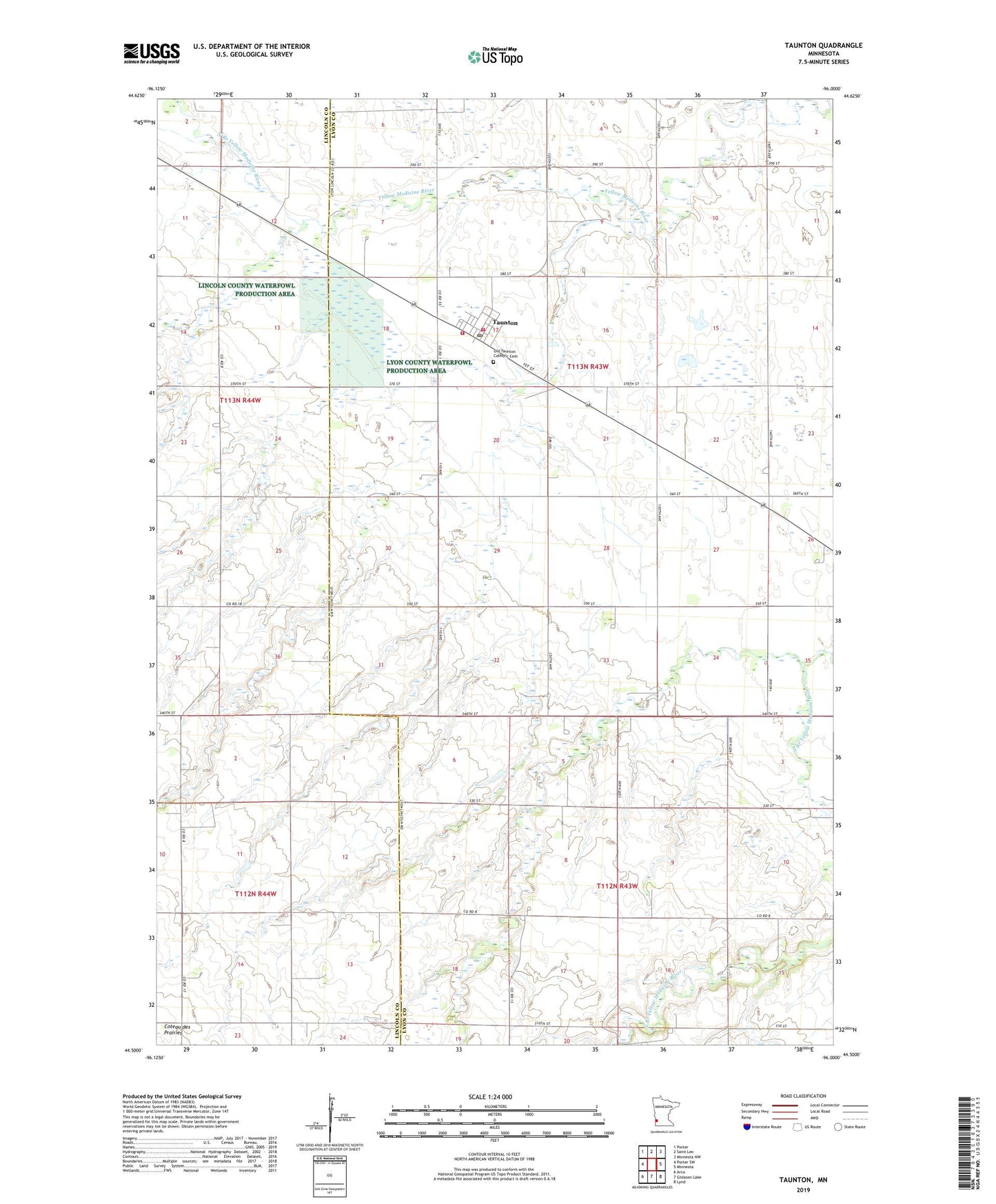
2022 topographic map quadrangle Taunton in the state of Minnesota. Scale: 1:24000. Based on the newly updated USGS 7.5' US Topo map series, this map is in the following counties: Lyon, Lincoln. The map contains contour data, water features, and other items you are used to seeing on USGS maps, but also has updated roads and other features. This is the next generation of topographic maps. Printed on high-quality waterproof paper with UV fade-resistant inks.
Quads adjacent to this one:
West: Porter SW
Northwest: Porter
North: Saint Leo
Northeast: Minneota NW
East: Minneota
Southeast: Lynd
South: Gislason Lake
Southwest: Arco
This map covers the same area as the classic USGS quad with code o44096e1.
Contains the following named places: City of Taunton, Hemnes Church, North Branch Yellow Medicine River, Old Taunton Catholic Cemetery, Taunton, Taunton City Hall, Taunton Fire Department Station 1, Taunton Fire Department Station 2, Taunton Post Office, Township of Eidsvold, Township of Nordland, Vernon Mack Dam