MyTopo
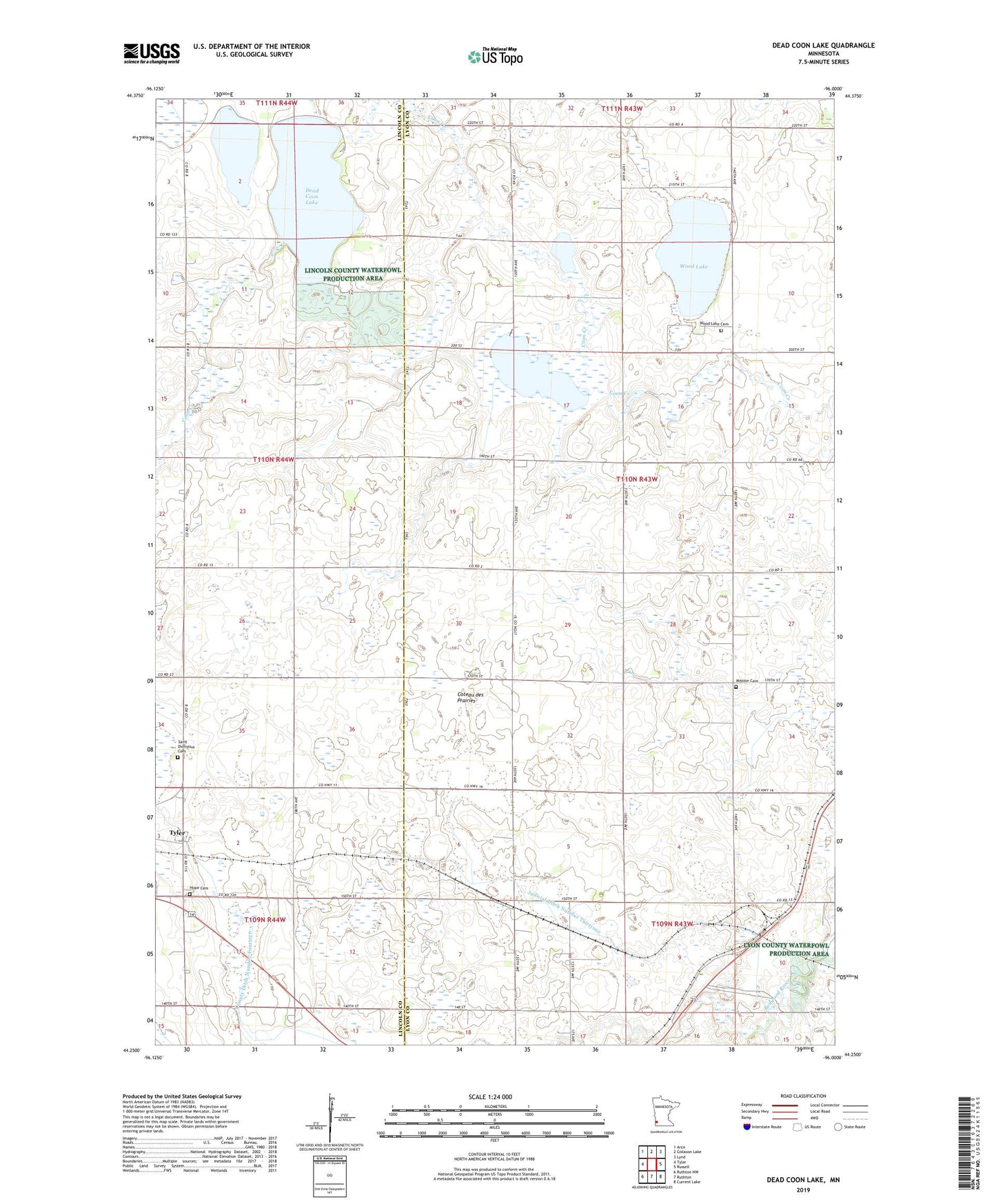
Dead Coon Lake Minnesota US Topo Map
Couldn't load pickup availability
2022 topographic map quadrangle Dead Coon Lake in the state of Minnesota. Scale: 1:24000. Based on the newly updated USGS 7.5' US Topo map series, this map is in the following counties: Lyon, Lincoln. The map contains contour data, water features, and other items you are used to seeing on USGS maps, but also has updated roads and other features. This is the next generation of topographic maps. Printed on high-quality waterproof paper with UV fade-resistant inks.
Quads adjacent to this one:
West: Tyler
Northwest: Arco
North: Gislason Lake
Northeast: Lynd
East: Russell
Southeast: Current Lake
South: Ruthton
Southwest: Ruthton NW
This map covers the same area as the classic USGS quad with code o44096c1.
Contains the following named places: Coon Creek, Coon Creek Dam, County Ditch Number Fourteen, Dead Coon Lake, Hope Cemetery, Judicial Ditch Number Thirtyone, Mission Cemetery, Saint Dionysius Cemetery, Township of Coon Creek, Wood Lake, Wood Lake Cemetery, ZIP Code: 56169