MyTopo
Melvin Minnesota US Topo Map
Couldn't load pickup availability
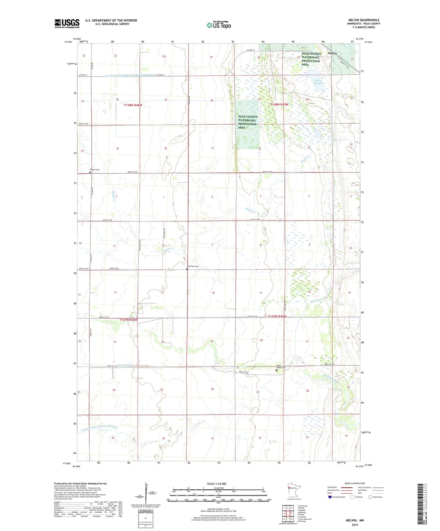
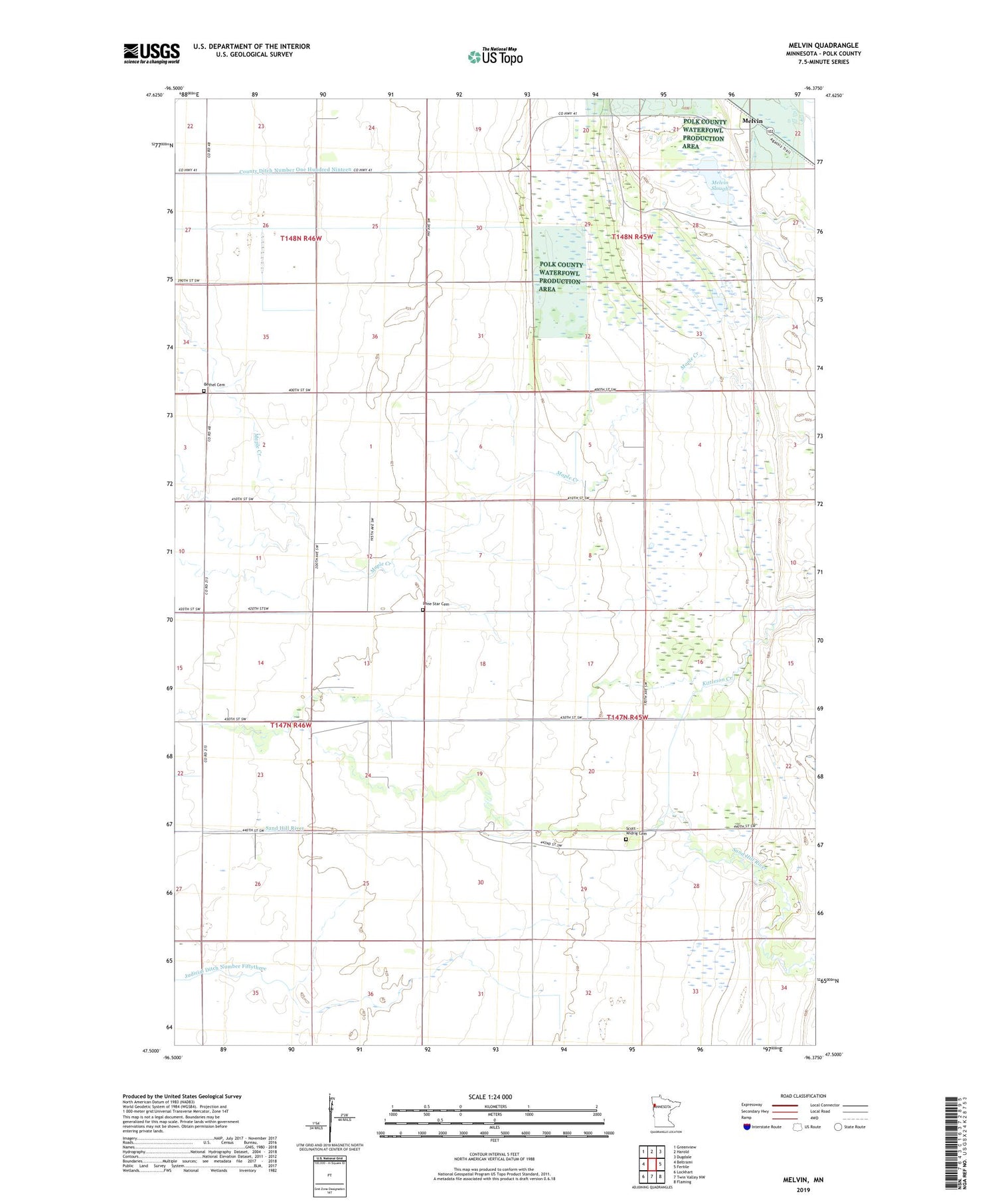
2019 topographic map quadrangle Melvin in the state of Minnesota. Scale: 1:24000. Based on the newly updated USGS 7.5' US Topo map series, this map is in the following counties: Polk. The map contains contour data, water features, and other items you are used to seeing on USGS maps, but also has updated roads and other features. This is the next generation of topographic maps. Printed on high-quality waterproof paper with UV fade-resistant inks.
Quads adjacent to this one:
West: Beltrami
Northwest: Greenview
North: Harold
Northeast: Dugdale
East: Fertile
Southeast: Flaming
South: Twin Valley NW
Southwest: Lockhart
Contains the following named places: Bethel Cemetery, County Ditch Number Eighty, Judicial Ditch Number Fiftythree, Kittleson Creek, Lone Star Cemetery, Melvin, Melvin Post Office, Melvin Slough, Scott - Widrig Cemetery, Township of Liberty