MyTopo
Twin Valley NW Minnesota US Topo Map
Couldn't load pickup availability
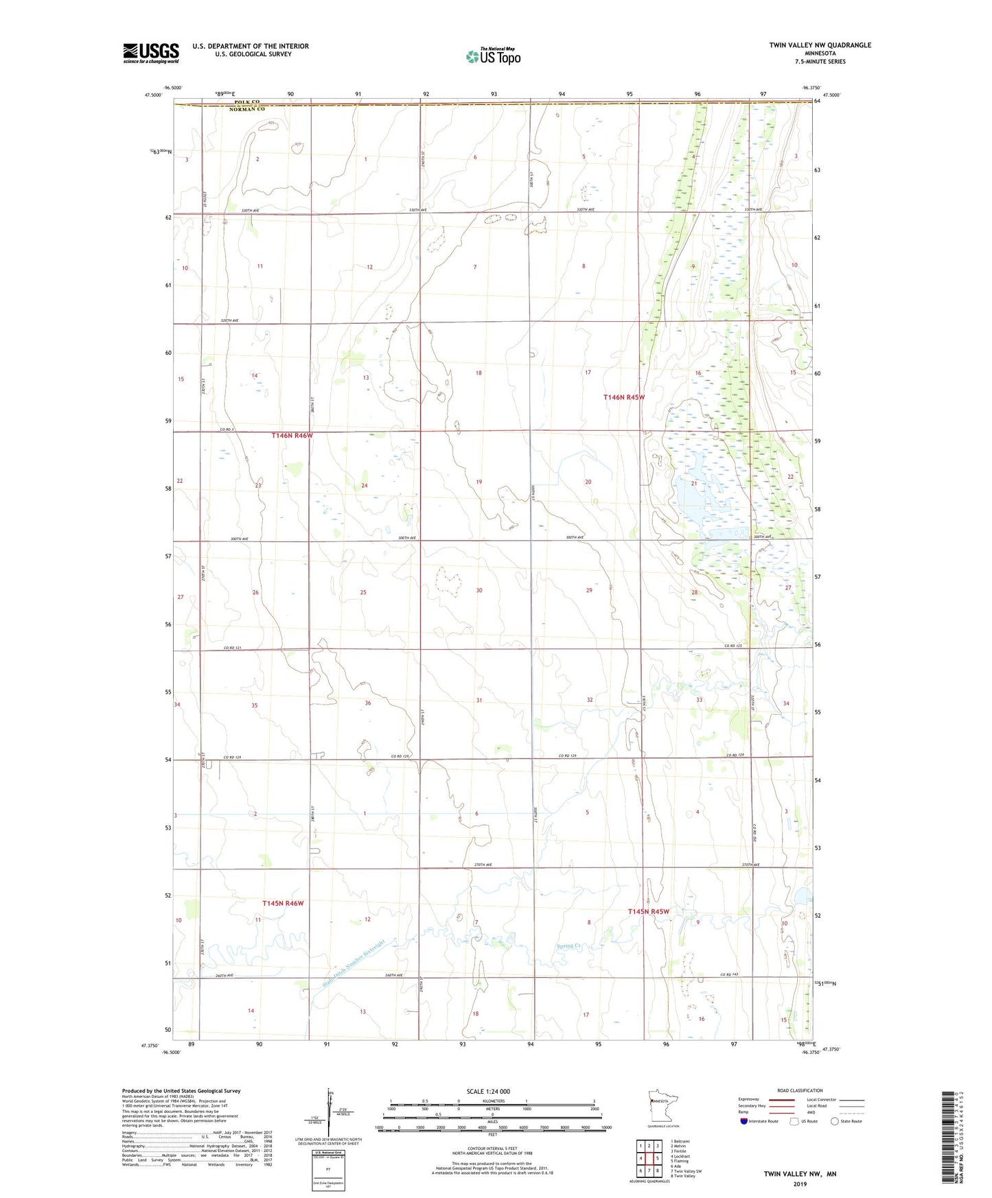
2022 topographic map quadrangle Twin Valley NW in the state of Minnesota. Scale: 1:24000. Based on the newly updated USGS 7.5' US Topo map series, this map is in the following counties: Norman, Polk. The map contains contour data, water features, and other items you are used to seeing on USGS maps, but also has updated roads and other features. This is the next generation of topographic maps. Printed on high-quality waterproof paper with UV fade-resistant inks.
Quads adjacent to this one:
West: Lockhart
Northwest: Beltrami
North: Melvin
Northeast: Fertile
East: Flaming
Southeast: Twin Valley
South: Twin Valley SW
Southwest: Ada
This map covers the same area as the classic USGS quad with code o47096d4.
Contains the following named places: Agassiz Number 2 State Wildlife Management Area, Betcher Post Office, County Ditch Number Sixtysix, County Ditch Number Thirtyeight, Green Meadow Group Pond, Green Meadow Group Pond Dam, Lockhart Swamp, Township of Spring Creek