MyTopo
Harold Minnesota US Topo Map
Couldn't load pickup availability
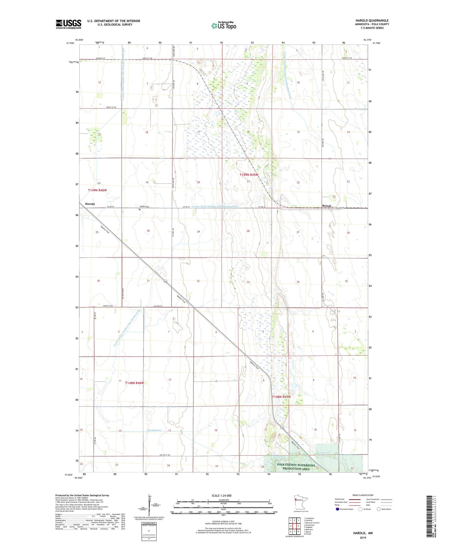
2022 topographic map quadrangle Harold in the state of Minnesota. Scale: 1:24000. Based on the newly updated USGS 7.5' US Topo map series, this map is in the following counties: Polk. The map contains contour data, water features, and other items you are used to seeing on USGS maps, but also has updated roads and other features. This is the next generation of topographic maps. Printed on high-quality waterproof paper with UV fade-resistant inks.
Quads adjacent to this one:
West: Greenview
Northwest: Crookston
North: Gentilly
Northeast: Marcoux Corners
East: Dugdale
Southeast: Fertile
South: Melvin
Southwest: Beltrami
This map covers the same area as the classic USGS quad with code o47096f4.
Contains the following named places: Benoit, County Ditch Number Eleven, County Ditch Number One Hundred Five, County Ditch Number One Hundred Forty, County Ditch Number One Hundred Six, Hafslo Cemetery, Hafslo Chapel, Harold, Lawton Post Office, Township of Kertsonville, Township of Onstad