MyTopo
Nerstrand Minnesota US Topo Map
Couldn't load pickup availability
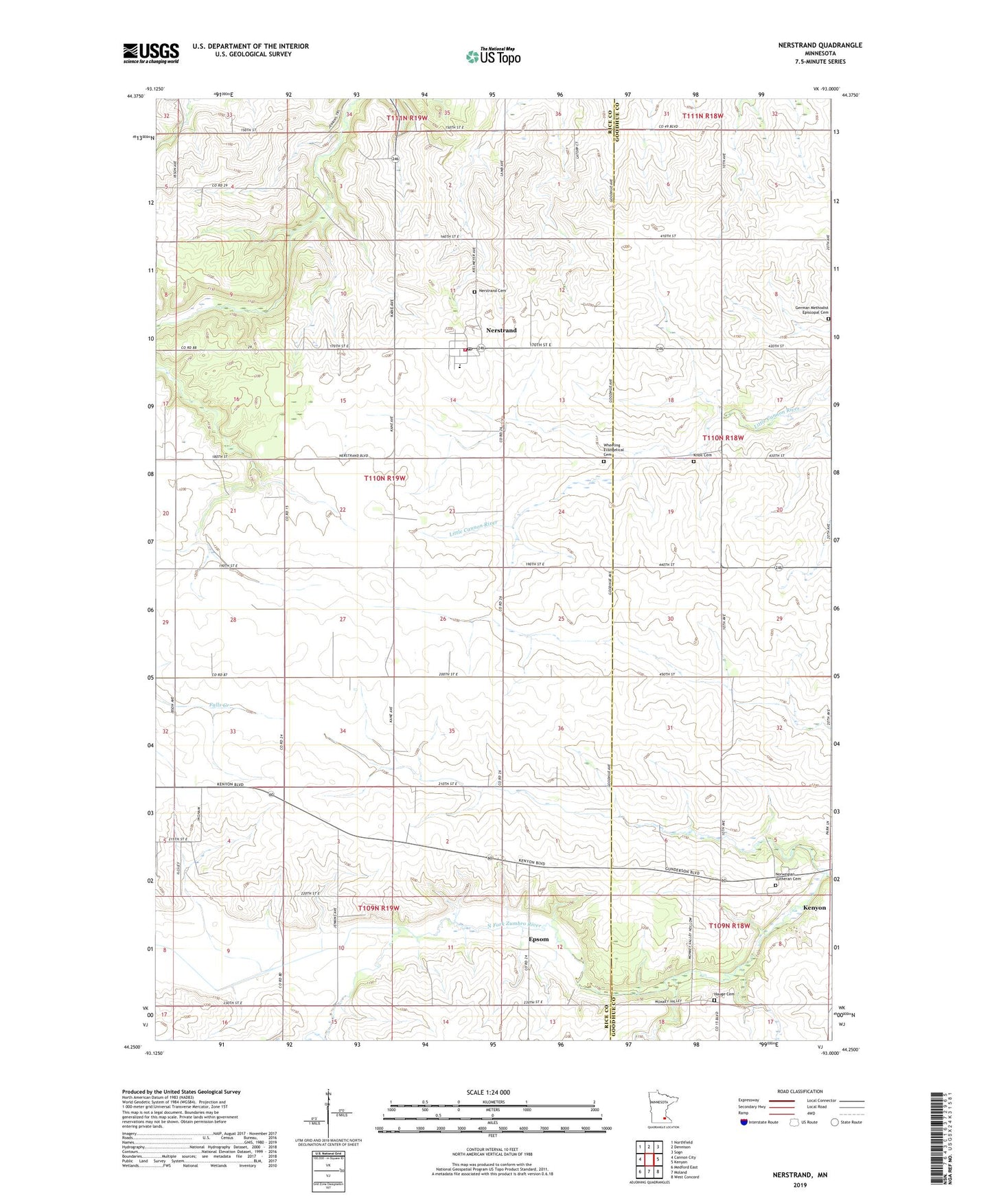
2019 topographic map quadrangle Nerstrand in the state of Minnesota. Scale: 1:24000. Based on the newly updated USGS 7.5' US Topo map series, this map is in the following counties: Rice, Goodhue. The map contains contour data, water features, and other items you are used to seeing on USGS maps, but also has updated roads and other features. This is the next generation of topographic maps. Printed on high-quality waterproof paper with UV fade-resistant inks.
Quads adjacent to this one:
West: Cannon City
Northwest: Northfield
North: Dennison
Northeast: Sogn
East: Kenyon
Southeast: West Concord
South: Moland
Southwest: Medford East
Contains the following named places: City of Nerstrand, Epsom, German Methodist Episcopal Cemetery, Gol Lutheran Church, Hauge Cemetery, Hauge Church, Kenyon Wayside Park, Knoll Cemetery, Nerstrand, Nerstrand Big Woods State Park, Nerstrand Cemetery, Nerstrand Elementary School, Nerstrand Post Office, Nerstrand Volunteer Fire Department, Norwegian Lutheran Cemetery, Prairieville Church, Saint Johns Church, Township of Wheeling, Valley Grove Church, Wheeling Evangelical Cemetery, ZIP Code: 55053